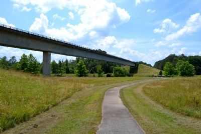
Near Belmont in Tishomingo County, Mississippi — The American South (East South Central)
River, Canal and Cut
Inscription.
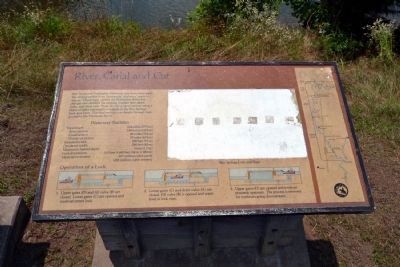
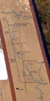
The Tennessee-Tombigbee Waterway has three main parts. The largest section from Demopolis, Alabama, north to Amory, Mississippi, utilizes the Tombigbee River but changes and shortens the existing channel with dams, locks, and short cuts. From Amory a canal section using a chain-of-lakes construction extends to the Bay Springs Lock and Dam. The final section cuts deeply through high ground to the Tennessee River.
Waterway Statistics
Total length 234 miles (377 km)
River section 149 miles (240 km)
Canal section 46 miles (74 km)
Divide cut section 39 miles (63 km)
Standard width 300 feet (91 m)
Divide cut width 280 feet (85 m)
Minimum channel depth 9 feet (2.7 m)
Lock dimensions 110 feet X 600 feet (34 m X 183 m)
Material excavated 307 million cubic yards (235 million cubic meters)
Operation of a Lock
1. Upper gates (D) and fill valve (B) are closed. Lower gates (C) are opened and towboat enters lock.
2. Lower gates (C) and drain valve (A) are closed. Fill valve (B) is opened and water level in lock rises.
3. Upper gates (D) are opened and towboat proceeds upstream. The process is reversed for towboats going downstream.
Erected by National Park Service.
Topics and series. This historical marker is listed in this topic list: Waterways & Vessels. In addition, it is included in the Natchez Trace series list.
Location. 34° 30.34′ N, 88° 19.435′ W. Marker is near Belmont, Mississippi, in Tishomingo County. Marker can be reached from Natchez Trace Parkway (at milepost 293.2), 0.3 miles west of John Rankin Highway (County Road 1). Marker is located 500 feet west of the parking lot for the Tennessee - Tombigbee Waterway turnoff from the Natchez Trace Parkway. Touch for map. Marker is in this post office area: Dennis MS 38838, United States of America. Touch for directions.
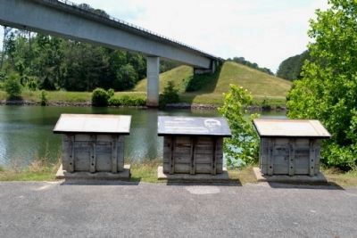
Other nearby markers. At least 8 other markers are within 10 miles of this marker, measured as the crow flies. Jamie L. Whitten Historic Landmark (here, next to this marker); Tennessee - Tombigbee Waterway (here, next to this marker); Butler Dogtrot Cabin (approx. 1.3 miles away); a different marker also named Butler Dogtrot Cabin (approx. 1.3 miles away); Pharr Mounds (approx. 6 miles away); Mac McAnally (approx. 6½ miles away); Donivan Slough (approx. 9.2 miles away); a different marker also named Donivan Slough (approx. 9.2 miles away). Touch for a list and map of all markers in Belmont.
Also see . . .
1. Natchez Trace. Official National Park Service website. (Submitted on June 26, 2015.)
2. Tennessee - Tombigbee Waterway. From the Encyclopedia of Alabama. (Submitted on June 26, 2015.)
Credits. This page was last revised on June 16, 2016. It was originally submitted on June 26, 2015, by Duane Hall of Abilene, Texas. This page has been viewed 409 times since then and 17 times this year. Photos: 1, 2, 3, 4, 5. submitted on June 26, 2015, by Duane Hall of Abilene, Texas.
