Near Limestone in Greene County, Tennessee — The American South (East South Central)
Unionist Stronghold
The Civil War in Greene County
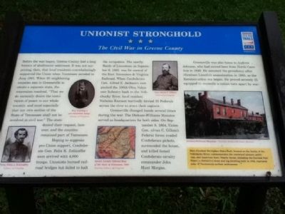
Hoping to suppress pro-Union support, Confederate Gen. Felix K. Zollicoffer soon arrived with 4,000 troops. Unionists burned rail-road bridges but failed to halt the occupation. The nearby Battle of Limestone on September 8, 1863, was for control of the East Tennessee & Virginia Railroad. When Confederate Gen. Alfred E. Jackson's men pushed the 100th Ohio Volunteer Infantry back to the Nolichucky river, local resident Nicholas Earnest hurriedly ferried 35 Federals across the river to avert their capture.
Greeneville changed hands several times during the war. The Dickson-Williams Mansion served as headquarters for both sides. On September 8, 1864, Union Gen. Alvan C. Gillem's Federal forces evaded Confederate pickets, surrounded the house, and killed famed Confederate cavalry commander John Hunt Morgan.
Greeneville was also home to Andrew Johnson, who moved here from North Carolina in 1826. He assumed the presidency after Abraham Lincoln's assassination in 1865, as the Reconstruction Era began. He proved severely ill-equipped to resoncile a nation torn apart by war.
(sidebar)
Davey Crockett Birthplace State Park, located on the banks of the River, commemorates the renowned pioneer, politician, and American hero. Nearby including the Fort House, a distinctive and log dwelling built in 17, represent some of Tennessee's earliest settlements.
(captions)
Gen. Felix J. Zollicoffer
Erected by Tennessee Civil War Trails.
Topics and series. This historical marker is listed in this topic list: War, US Civil. In addition, it is included in the Former U.S. Presidents: #17 Andrew Johnson, and the Tennessee Civil War Trails series lists. A significant historical month for this entry is June 1861.
Location. 36° 12.477′ N, 82° 39.318′ W. Marker is near Limestone, Tennessee, in Greene County. Marker can be reached from Davy Crockett Park Road. This marker is located in the David Crockett Birthplace State Historic Park. Touch for map. Marker is at or near this postal address: 1245 Davy Crockett Park Rd, Limestone TN 37681, United States of America. Touch for directions.
Other nearby markers. At least 8 other markers are within 2 miles of this marker, measured as the crow flies. Crockett (approx. ¼ mile away); The Real Likeness of David Crockett (approx. ¼ mile away); Crockett’s Tennessee Westward Movement (approx. ¼ mile away); Welcome to Davy Crockett Birthplace State Park (approx. ¼ mile away); A Summary of the Life of Davy Crockett (approx. ¼ mile away); Davy Crockett’s Birthplace (approx. ¼ mile away); Eye-Witness to a Near Tragedy (approx. 0.3 miles away); Battle of Limestone Station (approx. 1.6 miles away). Touch for a list and map of all markers in Limestone.
Credits. This page was last revised on June 16, 2016. It was originally submitted on June 27, 2015, by Tom Bosse of Jefferson City, Tennessee. This page has been viewed 766 times since then and 21 times this year. Photo 1. submitted on June 27, 2015, by Tom Bosse of Jefferson City, Tennessee. • Bernard Fisher was the editor who published this page.
