Near Columbus in Lowndes County, Mississippi — The American South (East South Central)
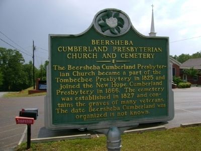
Beersheba Cumberland Presbyterian Church and Cemetery
Inscription.
The Beersheba Cumberland Presbyterian Church became part of the Tombecbee Presbytery in 1825 and joined the New Hope Cumberland Presbytery in 1866. The cemetery was established in 1827 and contains the graves of many veterans. The date Beersheba Cumberland was organized is not known.
Erected 1992 by Mississippi Department of Archives and History.
Topics and series. This historical marker is listed in these topic lists: Cemeteries & Burial Sites • Churches & Religion. In addition, it is included in the Mississippi State Historical Marker Program series list. A significant historical year for this entry is 1825.
Location. 33° 28.143′ N, 88° 18.078′ W. Marker is near Columbus, Mississippi, in Lowndes County. Marker is on Beersheba Road. It is at the southeast corner of the cemetery. Touch for map. Marker is at or near this postal address: 1736 Beersheba Rd, Columbus MS 39702, United States of America. Touch for directions.
Other nearby markers. At least 8 other markers are within 7 miles of this marker, measured as the crow flies. William Barksdale (approx. 2.9 miles away); Samuel A. Edmondson (approx. 4 miles away); Brownlee Family Cemetery - 1825 (approx. 4 miles away); Rural Hill School (approx. 4.1 miles away); Adam Tonquin Stovall (approx. 6.1 miles away); Sandfield Cemetery (approx. 6.1 miles away); Baldwin Locomotive No. 601 (approx. 6.7 miles away); Kenneth Gatchell House (approx. 6.9 miles away). Touch for a list and map of all markers in Columbus.
Credits. This page was last revised on January 22, 2017. It was originally submitted on June 22, 2008, by Davis Darryl Hartness of Columbus, Mississippi. This page has been viewed 2,177 times since then and 22 times this year. Photo 1. submitted on June 22, 2008, by Davis Darryl Hartness of Columbus, Mississippi. • J. J. Prats was the editor who published this page.
Editor’s want-list for this marker. A photograph of the marker and the surrounding area in context. • Can you help?
