Near Giddings in Lee County, Texas — The American South (West South Central)
James Goucher
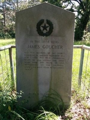
In this grave rests James Goucher and five members of his family murdered by Indians November 26, 1836. With the true pioneering spirit he had opened the first road from San Felipe to the settlements on the Colorado, known for many years as "Goucher's Trace"
Erected 1936 by State of Texas. (Marker Number 8154.)
Topics and series. This historical marker is listed in these topic lists: Cemeteries & Burial Sites • Settlements & Settlers • Wars, US Indian. In addition, it is included in the Texas 1936 Centennial Markers and Monuments series list. A significant historical date for this entry is November 26, 1844.
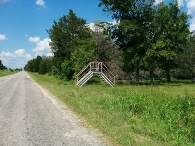
Location. 30° 7.772′ N, 96° 56.879′ W. Marker is near Giddings, Texas, in Lee County. Marker can be reached from County Road 217, 0.6 miles south of County Route 216, on the left when traveling south. Look for stairs crossing over a fence on the south side of CR 217. Touch for map. Marker is in this post office area: Giddings TX 78942, United States of America. Touch for directions.
Other nearby markers. At least 8 other markers are within 4 miles of this marker, measured as the crow flies. Serbin (approx. 2.6 miles away); a different marker also named Serbin (approx. 3.1 miles away); City of Giddings (approx. 3.6 miles away); Milton Garrett York, Sr. (approx. 3.6 miles away); First Baptist Church of Giddings (approx. 3.6 miles away); Lee County (approx. 3.6 miles away); Lee County Courthouse (approx. 3.7 miles away); First United Methodist Church of Giddings (approx. 3.7 miles away). Touch for a list and map of all markers in Giddings.
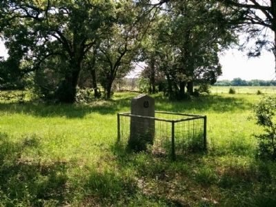
More about this marker. Marker is in the trees to the southeast (left) after climbing over the stairs.
Related markers. Click here for a list of markers that are related to this marker. Markers related to the Gotier / Gotcher Trace
Also see . . .
1. James Gotier in Handbook of Texas. (Submitted on June 22, 2015, by Gregory Walker of La Grange, Texas.)
2. Story of James Goacher massacre extracted from "Indian Depredations in Texas," by J W. Wilbarger. (Submitted on June 22, 2015, by Gregory Walker of La Grange, Texas.)
3. Various Accounts of the Gotcher Massacre. (Submitted on June 22, 2015, by Gregory Walker of La Grange, Texas.)
4. Complete "Indian Depredations in Texas" online. The James Goacher massacre story starts on page 15. (Submitted on June 22, 2015, by Gregory Walker of La Grange, Texas.)
Credits. This page was last revised on June 16, 2016. It was originally submitted on June 22, 2015, by Gregory Walker of La Grange, Texas. This page has been viewed 1,053 times since then and 74 times this year. Last updated on June 29, 2015, by Richard Denney of Austin, Texas. Photos: 1, 2, 3. submitted on June 22, 2015, by Gregory Walker of La Grange, Texas. • Bill Pfingsten was the editor who published this page.


