Archea Korinthos in Korinthos, Peloponnese, Western Greece and the Ionian, Greece — Ελλάδα (Southeastern Europe, Balkan Peninsula)
Temple of Apollo
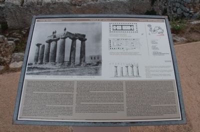
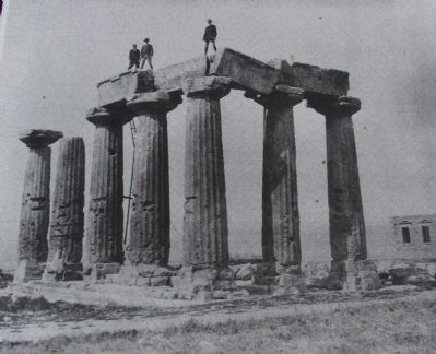
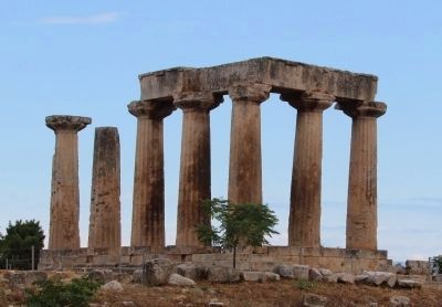
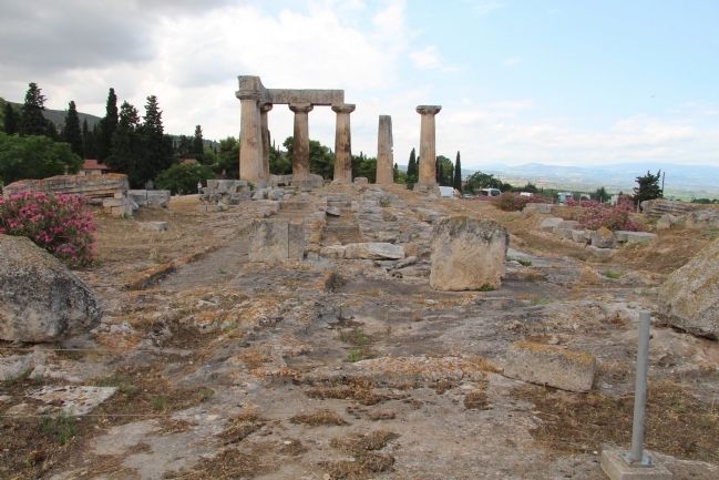
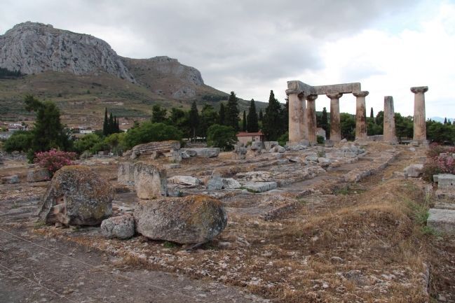
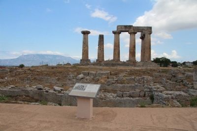
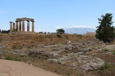
The seven standing columns of the Archaic temple are one of the most prominent landmarks of Corinth. Contrary to one's first impression, however, the view from this point is back of the building. The dedication of the temple to Apollo is deduced from Pausanias' description of Corinth combined with a small plaque which was dedicated to Apollo and fount in the area. Built in the middle of the 6th century B.C. to replace a destroyed 7th century predecessor, the temple is in Doric order and originally had six columns at each end and fifteen along each side. Notable characteristics of its archaic date include the great length of the temple relative to its width, the large monolithic columns, and the squat, widely flaring capitals.
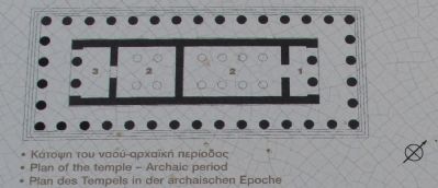
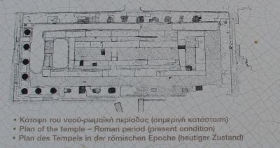
Although most of this mid-6th century B.C. building has been destroyed, the bedrock preserves cuttings made to receive the foundation blocks and thus allows a reconstruction of the temple's plan. The interior of the temple consists of a porch at either end and a long central part (the cella) divided into two rooms by a cross wall. The traditional reconstruction of the plan makes this cross wall a solid wall and provides access to the western room of the cella through the western door. Alternatively, the cross wall may have been pierced by a doorway, in which case the western room could have served as an inner shrine (an adyton). In any case, two rows of columns ran the length of the building within the interior.
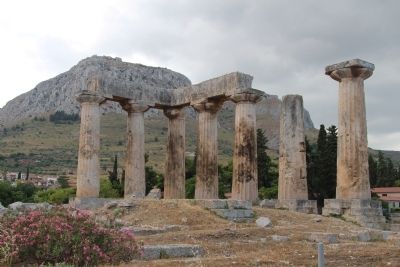
From the Archaic period, access to the hilltop was up a monumental staircase at the southeast corner of the hill. The Roman period, however, introduced many changes to the area. Access to the temple was now from the west. This change resulted from building activity on the other three sides of the hill which blocked off the earlier staircase and quarried into the sides of the hill. The Romans also carried out a radical renovation of the temple itself. The interior columns were removed and some of them were set up in a row near the west end of the South Stoa where they are still standing.
Erected by LZ Ephoreia of Prehistoric & Classical Antiquities.
Topics. This historical marker is listed in this topic list: Notable Places.
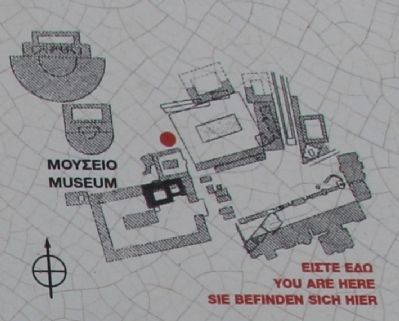
Location. 37° 54.351′ N, 22° 52.715′ E. Marker is in Archea Korinthos, Peloponnese, Western Greece and the Ionian, in Korinthos. Marker can be reached from Argous north of EO Korinthou Argous (Local Route 7), on the left when traveling north. This marker is located in the Archaeological Park of Ancient Corinth, and is one of the early markers that visitors encounter upon first entering
the archaeological park. Touch for map. Marker is at or near this postal address: Argous 105, Archea Korinthos, Peloponnese, Western Greece and the Ionian 200 07, Greece. Touch for directions.
Other nearby markers. At least 8 other markers are within walking distance of this marker. Glauke Fountain (within shouting distance of this marker); Ancient Corinth (within shouting distance of this marker); Road Network (within shouting distance of this marker); Archaeological Site of Ancient Corinth (about 90 meters away, measured in a direct line); Buildings at the West End of Roman Agora (about 90 meters away); Temple E (about 120 meters away); Lechaion Road (about 150 meters away); The Rostra (Bema) of the Roman Forum (about 150 meters away). Touch for a list and map of all markers in Archea Korinthos.
More about this marker. With regards to the location of all of the markers in the Archaeological Park of Ancient Corinth, when going online and researching directional information, I could not locate any websites, or any online maps, that provided the names of the local streets, so it was difficult for me to provide accurate and detailed directional information. The street and crossroad that I have provided are the closest two "named" streets that I could locate on any of the maps that I used.
One online site provided the following directions for getting to the archaeological park: "By car: 90 minutes
from Athens. The exit to Ancient Corinth, approaching from the north, is about 2 kilometers west of the Tripolis interchange. Warning: visitors familiar with the village before 1996 should take the Patras interchange not the new Tripolis highway to arrive from the other side of the village; no exit was constructed and a U-turn cannot be made for ten kilometers."
Credits. This page was last revised on March 22, 2022. It was originally submitted on June 30, 2015, by Dale K. Benington of Toledo, Ohio. This page has been viewed 412 times since then and 14 times this year. Photos: 1, 2, 3, 4, 5, 6, 7, 8, 9, 10, 11. submitted on July 1, 2015, by Dale K. Benington of Toledo, Ohio.
