Waterfront in Buffalo in Erie County, New York — The American Northeast (Mid-Atlantic)
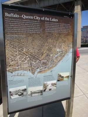
Buffalo - Queen City of the Lakes
Erie Canalway National Heritage Corridor
Because all of those products and people had to change from one mode of travel to the next here in Buffalo, the city became the hinge point between the Atlantic and the Great Lakes and the incubator for Cleveland, Toledo, Detroit, Chicago, and Duluth. By the mid-1800's Buffalo was called "the greatest inland port in the world."
Commercial and Residential Neighborhoods. As Buffalo grew and thrived, the city's commercial and residential districts expanded inland on higher ground.
Erie Canal. Commercial Slip and the section of the Erie Canal between Tonawanda and Buffalo were abandoned in the 1920's. Interstate 190 now runs on the old canal bed.
In the 1800s over 6,800 cargo vessels were registered on New York's canal system. Some days it seemed like they were all here in Buffalo.
Canal District. Buffalo's waterfront was a lively place. Grain elevators, flour mills, coal trestles, lumber yards, and commodity brokers served the cargo. Boarding houses and implement suppliers catered to migrants. Boat yards, ship chandlers, and sail lofts supplied the needs of lake and canal boats. Taverns and brothels served their crews.
The galleried buildings along Central Wharf housed the Buffalo Board of Trade, grain brokers, wholesalers, insurance companies, and other businesses that profited from lake navigation, canal traffic, and the transfer of cargos between the two.
Industry and Transportation. The transportation and industrial activities that funded much of Buffalo's prosperity crowded along the waterfront. A network of slips, side cuts, canals, and basins were cut to facilitate transfer of goods.
Grain elevators were signal elements of the Buffalo skyline. They received Midwestern grain from lake freighters, stored it, and then dispersed it to canal boats and rail cars for distribution to New York City and the world beyond.
Rail cars emptied their loads of Pennsylvania coal onto upper levels of trestles that lined Buffalo harbor. Gravity-fed chutes loaded canal boats that carried fuel to midwestern industries and homes.
Erected by U.S. Department of the Interior.
Topics and series. This historical marker is listed in this topic list: Waterways & Vessels. In addition,
it is included in the Erie Canal series list. A significant historical month for this entry is October 1825.
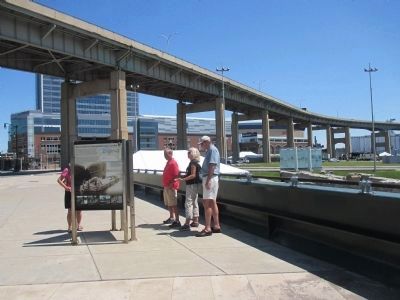
Location. 42° 52.66′ N, 78° 52.739′ W. Marker is in Buffalo, New York, in Erie County. It is in Waterfront. Marker can be reached from the intersection of Marine Drive and Commercial Street. Marker is one of three in triangle on the Marine Drive bride over the Commercial Slip. This marker, of the three, faces the Commercial Slip. Touch for map. Marker is in this post office area: Buffalo NY 14202, United States of America. Touch for directions.
Other nearby markers. At least 8 other markers are within walking distance of this marker. The Grand Canal (here, next to this marker); Erie Canalway National Heritage Corridor (here, next to this marker); Buffalo Riverfront Historical Eras to 1930 (here, next to this marker); The Ruins at Canalside (within shouting distance of this marker); A Changing Waterfront (within shouting distance of this marker); Buffalo - A Network of Canals (within shouting distance of this marker); William Wells Brown (within shouting distance of this marker); Buffalo - An Industrial Powerhouse (within shouting distance of this marker). Touch for a list and map of all markers in Buffalo.
Credits. This page was last revised on February 16, 2023. It was originally submitted on July 1, 2015, by Anton Schwarzmueller of Wilson, New York. This page has been viewed 554 times since then and 54 times this year. Photos: 1, 2. submitted on July 1, 2015, by Anton Schwarzmueller of Wilson, New York.

