Barnwell in Barnwell County, South Carolina — The American South (South Atlantic)
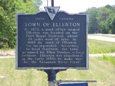
Town of Ellenton
Erected 1980 by Ellenton Agricultural Club. (Marker Number 6-2R.)
Topics. This historical marker is listed in these topic lists: Industry & Commerce • Notable Places. A significant historical year for this entry is 1873.
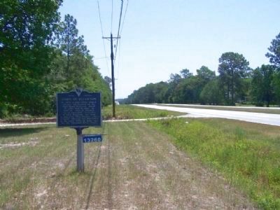
Location. 33° 14.461′ N, 81° 25.429′ W. Marker is in Barnwell, South Carolina, in Barnwell County. Marker is on Dunbarton Boulevard (State Highway 64), on the right when traveling west. Marker is located at the western end of Barnwell city limits. Touch for map. Marker is at or near this postal address: 13260 Dunbarton Blvd, Barnwell SC 29812, United States of America. Touch for directions.
Other nearby markers. At least 8 other markers are within 4 miles of this marker, measured as the crow flies. Ellenton Agricultural Club (within shouting distance of this marker); Barnwell School District #45 KIA Monument (approx. 2.9 miles away); Barnwell Army Airfield (approx. 2.9 miles away); "The Jefferson Airplane" (approx. 2.9 miles away); Red Hill At Turkey Creek (approx. 3.2 miles away); Fuller Park (approx. 3.2 miles away); Barnwell Baptist Church Cemetery (approx. 3.3 miles away); Calhoun Park (approx. 3.4 miles away). Touch for a list and map of all markers in Barnwell.
Also see . . . Ellenton, South Carolina, in Wikipedia. On November 28, 1950, the U.S. Atomic Energy Commission and the E. I. du Pont de Nemours Company announced that the Savannah River Plant would be built on about 300 sq. mi. of Aiken County, Barnwell County, and Allendale County in South Carolina. The Savannah River Plant was built for the production of plutonium and tritium for the H-bomb. (Submitted on June 22, 2008, by Mike Stroud of Bluffton, South Carolina.)
Credits. This page was last revised on June 16, 2016. It was originally submitted on June 22, 2008, by Mike Stroud of Bluffton, South Carolina. This page has been viewed 1,689 times since then and 22 times this year. Photos: 1, 2. submitted on June 22, 2008, by Mike Stroud of Bluffton, South Carolina. • Christopher Busta-Peck was the editor who published this page.

