Archea Korinthos in Korinthos, Peloponnese, Western Greece and the Ionian, Greece — Ελλάδα (Southeastern Europe, Balkan Peninsula)
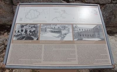
Peirene Fountain
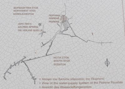
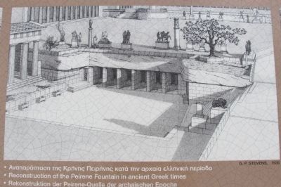
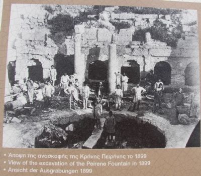
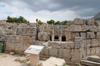
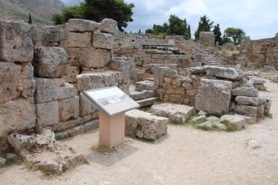
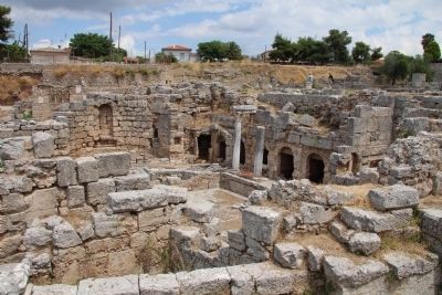
Peirene is one of the most important topoi in the urban landscape of both Greek and Roman Corinth. Human activity is attested in the area from the Neolithic period, and the first efforts in water management date to the Geometric period. The facility was gradually embellished from the Archaic period forward, so that by the 2nd century B.C., it consisted of six chambers providing access to three deep draw basins supplied with water by conduits excavated hundreds of meters back under the forum. The water was stored in four huge reservoirs.
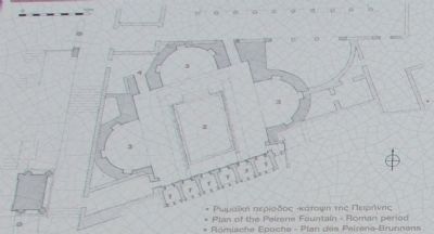
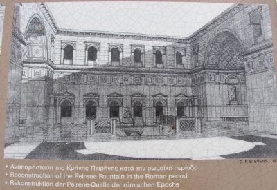
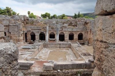
Peirene was one of the first structures rebuilt after the establishment of the Roman colony. The fountain was now housed within a large rectangular court. The facade of this phase had Doric half-columns between arches framing the earlier antechambers. The second storey was a solid wall with engaged Ionic half-columns. The Doric and Ionic blind colonnade also adorned the east and west walls of the court. The central sunken rectangle is a draw basin accessed by a short broad stair and not a pool. Waterspouts in the sides of the basin were served by large conduits running under the courtyard floor.
Following the partial destruction of the earlier phase, perhaps by earthquake, the east and west apses were added in Late Antiquity and the reused marble columns and their decorative “outlookers” in front of the facade are Byzantine additions. In later centuries, the ground level rose and the court was occupied by a small chapel and cemetery. Even after the fountain and courtyard were completely buried, the fountain continued to provide water for the village fountains and numerous wells.
Myth records two origins for the spring. In one Poseidon’s lover Peirene literally dissolved into tears when Artemis accidentally killed her son Kenchrias. The other attributes its creation to the hoof print of the winged horse Pegasus when he stamped in irritation on being bridled by Bellerophon.
Erected by LZ Ephoreia of Prehistoric & Classical Antiquities.
Topics. This historical marker is listed in this topic list: Notable Places.
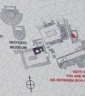
Location. 37° 54.352′ N, 22° 52.831′ E. Marker is in Archea Korinthos, Peloponnese, Western Greece and the Ionian, in Korinthos. Marker is on Enotiki Archeas Korinthou north of EO Korinthou Argous (Local Route 7) when traveling north. This marker is located in the Archaeological Park of Ancient Corinth, at the south end of Lechaion Road, in the ruins on the eastern side of the road. Touch for map. Marker is in this post office area: Archea Korinthos, Peloponnese, Western Greece and the Ionian 200 07, Greece. Touch for directions.
Other nearby markers. At least 8 other markers are within
walking distance of this marker. Lechaion Road (within shouting distance of this marker); The Heroon at the Crossroads: an early sanctuary of Ancient Corinth (within shouting distance of this marker); Archaeological Site of Ancient Corinth (within shouting distance of this marker); The Rostra (Bema) of the Roman Forum (about 90 meters away, measured in a direct line); Saint Paul in Corinth and the Bema of the Roman Forum (about 90 meters away); South Stoa (about 120 meters away); Buildings at the West End of Roman Agora (about 150 meters away); Road Network (about 150 meters away). Touch for a list and map of all markers in Archea Korinthos.
More about this marker. With regards to the location of all of the markers in the Archaeological Park of Ancient Corinth, when going online and researching directional information, I could not locate any websites, or any online maps, that provided the names of the local streets, so it was difficult for me to provide accurate and detailed directional information. The street and crossroad that I have provided are the closest two "named" streets that I could locate on any of the maps that I used.
One online site provided the following directions for getting to the archaeological park: "By car: 90 minutes from Athens. The exit to Ancient Corinth, approaching
from the north, is about 2 kilometers west of the Tripolis interchange. Warning: visitors familiar with the village before 1996 should take the Patras interchange not the new Tripolis highway to arrive from the other side of the village; no exit was constructed and a U-turn cannot be made for ten kilometers."
Related markers. Click here for a list of markers that are related to this marker. To better understand the relationship, study each marker in the order shown.
Credits. This page was last revised on March 22, 2022. It was originally submitted on July 4, 2015, by Dale K. Benington of Toledo, Ohio. This page has been viewed 579 times since then and 52 times this year. Photos: 1. submitted on July 4, 2015, by Dale K. Benington of Toledo, Ohio. 2, 3, 4, 5, 6, 7, 8, 9, 10, 11. submitted on July 5, 2015, by Dale K. Benington of Toledo, Ohio.
