Archea Korinthos in Korinthos, Peloponnese, Western Greece and the Ionian, Greece — Ελλάδα (Southeastern Europe, Balkan Peninsula)
South Stoa
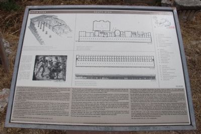
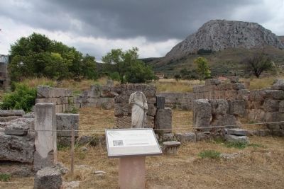
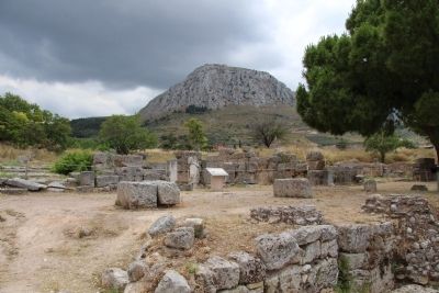
The South Stoa, one of the largest porticoed buildings in ancient Greece, was built in the late 4th century B.C., to the south of the race track of Corinth. The excavation of it by the American School of Classical Studies was begun in 1933 and completed in 1948.
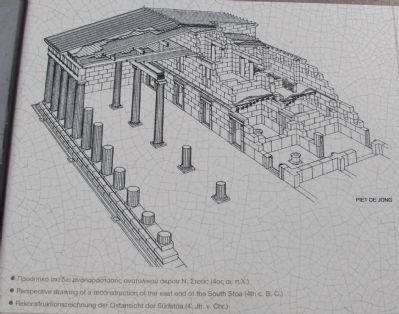
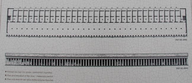
The Stoa covers an area of about 0.4 hectares and measures 164.38 meters x 25.15 meters. Its facade has 71 Doric columns, and it had a second internal colonnade of 34 Ionic columns. The back part of the Stoa consisted of 33 similar two-roomed apartments. The ground-floor rooms were equipped with wells to keep water and wine cool and served as shops and restaurants. Of these apartments in the Hellenistic Stoa, the three at the west are in a good state of preservation.
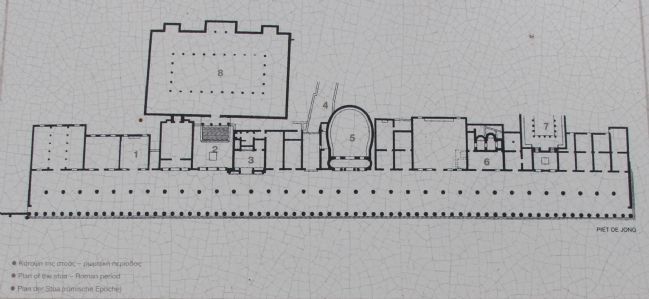
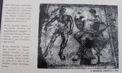
During the Roman period (1st-3rd centuries A.D.), the majority of the rooms in the Stoa were converted into separate areas of differing sizes and uses. Of these, we may single out: the Agonotheteion, which was connected with the Isthmian games, a propylon, which lead to the South Basilica, a fountain House, the Bouleuterion, which dates from the second half of the 1st century A.D., a Late Roman bath and public latrine dating from Late Antiquity.
About the middle of the 1st century A.D., a paved road leading to Kenchreai ran through the middle of the Stoa. Although the back part of the Stoa gradually lost its fine appearance and unified function, the front part, with the two colonnades, retained its form and unity.
The Stoa was finally abandoned in the 6th century A.D.
Erected by LZ Ephoreia of Prehistoric & Classical Antiquities.
Topics. This historical marker is listed in this topic list: Notable Places. A significant historical year for this entry is 1933.
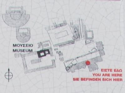
Location. 37° 54.286′ N, 22° 52.819′ E. Marker is in Archea Korinthos, Peloponnese, Western Greece and the Ionian, in Korinthos. Marker can be reached from Enotiki Archeas Korinthou north of EO Korinthou Argous (Local Route 7), on the left when traveling north. This marker is located in the Archaeological Park of Ancient Corinth, and is located in the ruins that are south of the Roman Forum and south of the Bema. Touch for map. Marker is in this post office area: Archea Korinthos, Peloponnese, Western Greece and the Ionian 200 07, Greece. Touch for directions.
Other nearby markers. At least 8 other markers are within walking distance of this marker. Saint Paul in Corinth and the Bema of the Roman Forum (within shouting distance of this marker); The Rostra (Bema) of the Roman Forum (within shouting distance of this marker); The Heroon at the Crossroads: an early sanctuary of Ancient Corinth (within shouting distance of this marker); Lechaion Road (about 90 meters away, measured in a direct
Photographed By Dale K. Benington, June 22, 2015
2. South Stoa Marker
Close-up view, that is displayed on the marker, of an illustration, showing the sporting subject of the mosaic adorning the Agonotheteion suggests a connection with the Isthmian Games, control of which returned to the Corinthians after 44 B.C.
More about this marker. With regards to the location of all of the markers in the Archaeological Park of Ancient Corinth, when going online and researching directional information, I could not locate any websites, or any online maps, that provided the names of the local streets, so it was difficult for me to provide accurate and detailed directional information. The street and crossroad that I have provided are the closest two "named" streets that I could locate on any of the maps that I used.
One online site provided the following directions for getting to the archaeological park: "By car: 90 minutes from Athens. The exit to Ancient Corinth, approaching from the north, is about 2 kilometers west of the Tripolis interchange. Warning: visitors familiar with the village before 1996 should take the Patras interchange
not the new Tripolis highway to arrive from the other side of the village; no exit was constructed and a U-turn cannot be made for ten kilometers."
Related markers. Click here for a list of markers that are related to this marker. To better understand the relationship, study each marker in the order shown.
Credits. This page was last revised on March 22, 2022. It was originally submitted on July 5, 2015, by Dale K. Benington of Toledo, Ohio. This page has been viewed 512 times since then and 42 times this year. Photos: 1, 2, 3, 4, 5, 6, 7, 8. submitted on July 5, 2015, by Dale K. Benington of Toledo, Ohio.
