Fredericksburg, Virginia — The American South (Mid-Atlantic)
The Confederate Line
The Battle of Fredericksburg
— Fredericksburg and Spotsylvania National Military Park —
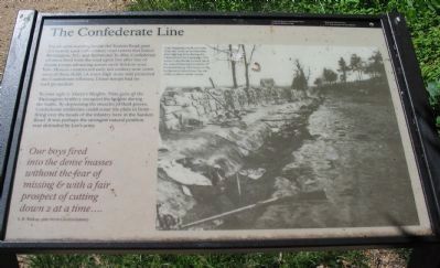
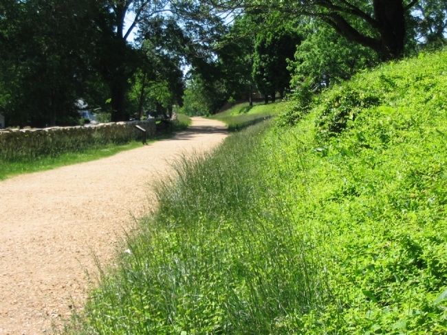
You are now standing beside the Sunken Road, part of a heavily used 19th-century road system that linked Washington, D.C. and Richmond. In 1862, Confederate riflemen fired from the road upon line after line of Union troops advancing across open fields to your left. (Houses constructed early last century now cover most of these fields.) A waist-high stone wall protected the Confederate riflemen; Union troops had no such protection.
To your right is Marye's Heights. Nine guns of the Washington Artillery occupied the heights during the battle. By depressing the muzzles of their pieces, Confederate artillerists could scour the plain in front - firing over the heads of infantry here in the Sunken Road. It was perhaps the strongest natural position ever defended by Lee's army.
Our boys fired into the dense masses without the fear of missing & with a fair prospect of cutting down 2 at a time....
S.H. Walkup, 48th North Carolina Infantry
Erected by National Park Service, U.S. Department of the Interior.
Topics. This historical marker is listed in this topic list: War, US Civil. A significant historical year for this entry is 1862.
Location. 38° 17.716′ N, 77° 28.101′ W. Marker is in Fredericksburg, Virginia. Marker is on Sunken Road, 0.1 miles Lafayette Boulevard (Virginia Highway 1), on the right when traveling north. Located on the Sunken Road walking trail, which starts at the Fredericksburg battlefield visitor center. The Sunken Road is closed to vehicle traffic. Touch for map. Marker is in this post office area: Fredericksburg VA 22401, United States of America. Touch for directions.
Other nearby markers. At least 8 other markers are within walking distance of this marker. Thomas R. R. Cobb (a few steps from this marker); Cobb (a few steps from this marker); Mrs. Martha Stevens (a few steps from this marker); The Stephens House (a few steps from this marker); Stephens Family Cemetery (within shouting distance of this marker); The Union Attacks Begin (within shouting distance of this marker); Field of Battle (within shouting distance of this marker); Confederates on the Heights (within shouting distance of this marker). Touch for a list and map of all markers in Fredericksburg.
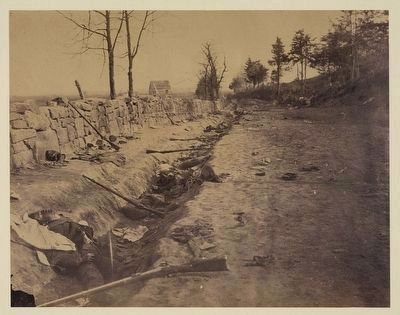
More about this marker. On the right side of the marker is a wartime photograph captioned, A photographer took a picture from this location in May 1863, after fighting here during the Chancellorsville Campaign. The scene undoubtedly looked much the same following the Battle of Fredericksburg. The house in the background stood near the site of the modern visitor center.
Credits. This page was last revised on February 2, 2023. It was originally submitted on June 23, 2008, by Craig Swain of Leesburg, Virginia. This page has been viewed 2,551 times since then and 26 times this year. Photos: 1. submitted on June 23, 2008, by Craig Swain of Leesburg, Virginia. 2. submitted on July 26, 2015, by Brandon Fletcher of Chattanooga, Tennessee. 3, 4. submitted on June 23, 2008, by Craig Swain of Leesburg, Virginia.


