Raymond in Hinds County, Mississippi — The American South (East South Central)
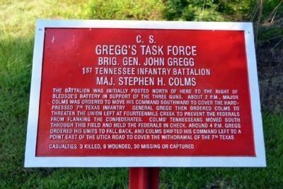
C.S. Gregg's Task Force
1st Tennessee Infantry Battalion
Brig. Gen. John Gregg
1st Tennessee Infantry Battalion
Maj. Stephen H. Colms
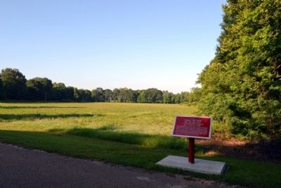
This battalion was initially posted north of here to the right of Bledsoe’s battery in support of the three guns. About 2 p.m., Major Colms was ordered to move his command southward to cover the hardpressed 7th Texas Infantry. General Gregg then ordered Colms to threaten the Union left at Fourteenmile Creek to prevent the Federals from flanking the Confederates. Colms’ Tennesseans moved south through this field and held the Federals in check. Around 4 p.m. Gregg ordered his units to fall back, and Colms shifted his command left to a point east of the Utica Road to cover the withdrawal of the 7th Texas.
Casualties 3 killed, 9 wounded, 30 missing or captured
Topics. This historical marker is listed in this topic list: War, US Civil.
Location. 32° 14.682′ N, 90° 26.625′ W. Marker is in Raymond, Mississippi, in Hinds County. Marker can be reached from Port Gibson Street, 0.1 miles north of Mississippi Highway 18, on the left when traveling north. Marker is located in the main part of the Raymond Military Park; the above directions are to the parking area for the park. Touch for map. Marker is in this post office area: Raymond MS 39154, United States of America. Touch for directions.
Other nearby markers. At least 8 other markers are within walking distance of this marker. The Campaign Turns East (a few steps from this marker); Battle of Raymond - This Walking Trail (within shouting distance of this marker); The Battle of Raymond as a Pivotal Point in the Vicksburg Campaign (within shouting distance of this marker); The Little J Railroad (within shouting distance of this marker); The Vicksburg Campaign (within shouting distance of this marker); Confederate Commanders (about 300 feet away, measured in a direct line); Confederate Route to Raymond (about 300 feet away); Gregg's Battle Plan (about 400 feet away). Touch for a list and map of all markers in Raymond.
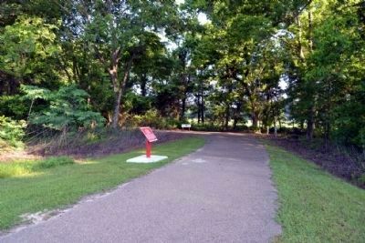
More about this marker. Marker is located along the Raymond Military Park walking trail northwest of the exhibit kiosk. It is a 400-foot walk from the parking area to the marker.
Also see . . . Friends of Raymond. Official website of the Friends of Raymond with detailed information on the Battle of Raymond and the preservation of the battlefield. (Submitted on July 6, 2015.)
Credits. This page was last revised on June 16, 2016. It was originally submitted on July 6, 2015, by Duane Hall of Abilene, Texas. This page has been viewed 336 times since then and 12 times this year. Photos: 1, 2, 3. submitted on July 6, 2015, by Duane Hall of Abilene, Texas.


