Athina in Kentrikos Tomeas Athinon, Attica, Greece — Ελλάδα (Southeastern Europe, Balkan Peninsula)
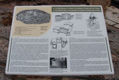
A. The Propylaia, B. The Shrine of Athena Hygieia and Hygieia
Inscription.
English Text:
A. The Propylaia
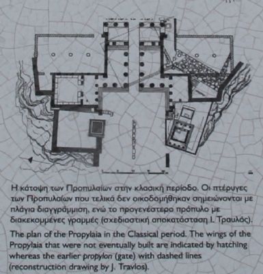
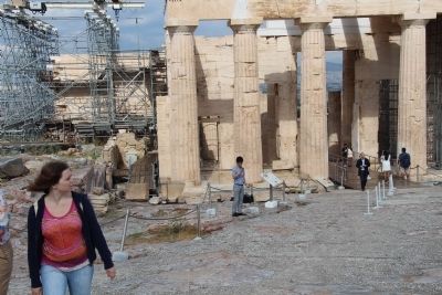
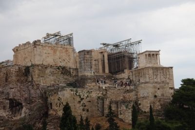
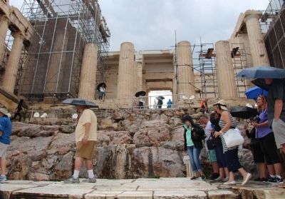
The Propylaia, the monumental entrance of the sanctuary of the Acropolis, was built at the west edge of the hill in the frame of the building programme of Perikles. The building's architect was Mnesikles, who applied ingenious and innovative architectural solutions. The construction of the Propylaia (437-432 B.C.) was interrupted by the outbreak of the Peloponnesian War, and as a result the original plan remained incomplete.
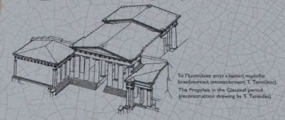
The Propylaia comprise a central building with an East-West direction and similar hexastyle (6 columns) Doric pedimental facades. A cross-wall with five doorways divides the central building into two parts. The longer western one is divided into three aisles by two Ionic colonnades, each of the three columns, which support the ceiling. The marble ceilings comprised beams and coffered slabs which had rich painted decoration. The central building of the Propylaia is flanked on the south and the north by two wings with a similar prostyle Doric porch. In the north wing the hall lying behind the porch might have served as a banquet and recreation hall for the worshippers. According to the traveler Pausanias (2nd century A.D.) the hall was decorated with paintings and for this reason is conventionally known as the "Pinakotheke" (picture gallery). The south wing consists only of a porch through which the sanctuary of Athens Nike was accessed.
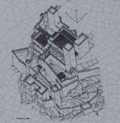
In the 6th century A.D., the south wing of the Propylaia was transformed into a single-aisle Christian basilica. In the Medieval times, Frankish and Florentine rulers converted the Propylaia into a palace and a tall tower was built at the south wing. During Ottoman Occupation, in 1640, the building was struck by a lightning or a cannonball which blew up the gunpowder stored there and caused extensive damage to the monument. The Medieval and later remains were removed during the excavations of the Acropolis in the 19th century, in order to reveal the Propylaia of the Classical period.
A. The shrine of Athena Hygieia and Hygieia
Southeast to the central building of the Propylaia is situated a small shrine dedicated both to Athena Hygieia (Health) and Hygieia, the daughter of Asklepeios, who was the god of medicine. The cult of Athena Hygieia on the Acropolis is dated since 6th century B.C., according to epigraphical testimonia, whereas the cult of Hygieia is dated around 420 B.C.
In the shrine, part of the rectangular altar and the cylindrical marble base of a bronze statue of Athena Hygieia made by the Athenian sculptor Pyrrhos are preserved. According to tradition (Plutarchus, Life of Perikles 13.7-8) the statue
was dedicated for the salvage of a workman who had suffered an accident during the construction of the Propylaia. However, it is more likely that the demos (people of Athens) dedicated the statue in relation to the plague that stroke the city at the beginning of the Peloponnesian War (429-427 B.C.).
Topics. This historical marker is listed in this topic list: Notable Places. A significant historical year for this entry is 1640.
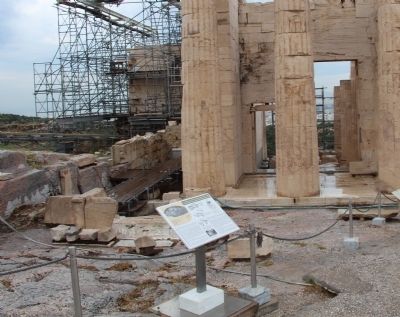
Location. 37° 58.301′ N, 23° 43.528′ E. Marker is in Athina, Attica, in Kentrikos Tomeas Athinon. Marker can be reached from Theorias north of Dionysiou Areopagitou Street, on the right when traveling north. This marker is part of the archaeological park that is located at the Acropolis of Athens, and is one of the very first markers that visitors encounter upon arriving at the top of the Acropolis. Touch for map. Marker is at or near this postal address: Theorias 21, Athina, Attica 105 58, Greece. Touch for directions.
Other nearby markers. At least 8 other markers are within walking distance of this marker. The Statue of Athena Promachos (a few steps from this marker); A. The Sanctuary of Artemis Brauronia, B. The Chalkotheke (a few steps from this marker); The Parthenon (within shouting distance of this marker); The "Old Temple" of Athena (about 90 meters away, measured in a direct line); The Erechtheion (about 90 meters away); The Area South of the Ancient Agora
(about 120 meters away); Areopagus Hill (about 180 meters away); The Acropolis of Athens (about 180 meters away). Touch for a list and map of all markers in Athina.
Photographed By Dale K. Benington, June 22, 2015
5. A. The Propylaia, B. The Shrine of Athena Hygieia and Hygieia Marker
Close-up view, that is displayed on the marker, of an illustration, showing the reconstructed west approach of the Acropolis and the Propylaia that was converted into a palace of the Frankish and Florentine rulers around 1450.
Photographed By Dale K. Benington, June 22, 2015
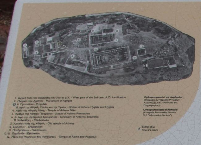
6. A. The Propylaia, B. The Shrine of Athena Hygieia and Hygieia Marker
Close-up view, that is displayed on the marker, of an Orthophotomosaic, showing where the Acropolis visitor is in relation to the ruins of the archaeological park, while standing in front of the marker.
Credits. This page was last revised on March 22, 2022. It was originally submitted on July 6, 2015, by Dale K. Benington of Toledo, Ohio. This page has been viewed 945 times since then and 121 times this year. Photos: 1, 2, 3, 4, 5, 6, 7, 8, 9, 10. submitted on July 7, 2015, by Dale K. Benington of Toledo, Ohio.
