Warrensburg
[Front]
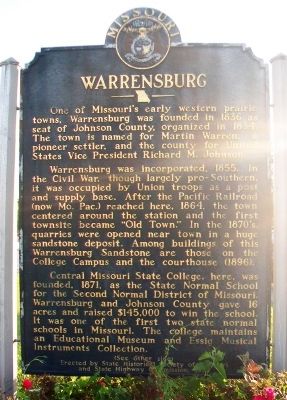
One of Missouri's early western prairie towns, Warrensburg was founded in 1836 as seat of Johnson County, organized in 1834. The town is named for Martin Warren, a pioneer settler, and the county for United States Vice President Richard M. Johnson.
Warrensburg was incorporated, 1855. In the Civil War, though largely pro-Southern, it was occupied by Union troops as a post and supply base. After the Pacific Railroad (now Mo. Pac.) reached here, 1864, the town centered around the station and the first townsite became "Old Town." In the 1870's, quarries were opened near town in a huge sandstone deposit. Among buildings of this Warrensburg Sandstone are those on the College Campus and the courthouse (1896).
Central Missouri State College, here, was founded, 1871, as the State Normal School for the Second Normal District of Missouri. Warrensburg and Johnson County gave 16 acres and raised $145,000 to win the school. It was one of the first two state normal schools in Missouri. The college maintains an Educational Museum and Essig Musical Instruments Collection.
(See other side)
[Back]
(Continued from other side)
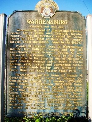
Warrensburg, seat of justice and training center for a grain and livestock farming county, lies in territory ceded by Osage tribes in 1808. First settlers in the county, largely
Points of interest here in Warrensburg include the College Campus and the Old Courthouse where Senator George G. Vest delivered his famous "Tribute to the Dog" in his plea to the jury in one of Missouri's most colorful damage suits. South is Pertle Springs, early resort and convention center. East, near Knob Noster, are Whit[e]man Air Force Base and Knob Noster State Park.
Warrensburg was the home of Francis M. Cockrell (1834-1915) a native of Johnson Co., Confederate general, U. S. senator, 1875-1905; and Thomas T. Crittenden (1832-1909) Union colonel, governor of Mo., 1881-85. Here also, for a time, lived Wells H. Blodgett (1839-1929) Union colonel, state legislator; Carry Moore Nation (1846-1911), Clara Cleghorn Hoffman (1831-1908), leaders in temperance movement; John W. (Blind) Boone (1864-1927) the Negro musician; and George MacCurdy (1863-1947) a native of Warrensburg, anthropologist.
Erected 1957 by State Historical Society of Missouri and State Highway Commission.
Topics and series. This historical marker is listed in these topic lists: Education • Industry & Commerce • Settlements & Settlers • War, US Civil. In addition, it is included in the Missouri, The State Historical Society of series list. A significant historical year for this entry is 1836.
Location.
Other nearby markers. At least 8 other markers are within 2 miles of this marker, measured as the crow flies. Pertle Springs (approx. 1˝ miles away); War Memorial (approx. 1˝ miles away); Johnson County Courthouse (approx. 1.6 miles away); Senator Vest's World Famous Tribute to Old Drum (approx. 1.6 miles away); Johnson County Centennial (approx. 1.6 miles away); U.S. Navy V-12 Unit (approx. 1.8 miles away); Welcome to Blind Boone Park (approx. 2 miles away); John William Boone (approx. 2 miles away). Touch for a list and map of all markers in Warrensburg.
Also see . . . Warrensburg, Missouri, History. City website entry (Submitted on July 12, 2015, by William Fischer, Jr. of Scranton, Pennsylvania.)
Credits. This page was last revised on July 3, 2022. It was originally submitted on July 12, 2015, by William Fischer, Jr. of Scranton, Pennsylvania. This page has been viewed 772 times since then and 23 times this year. Photos: 1, 2, 3. submitted on July 12, 2015, by William Fischer, Jr. of Scranton, Pennsylvania.


