Addison in Addison County, Vermont — The American Northeast (New England)
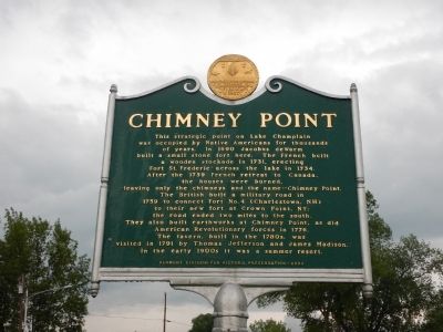
Chimney Point
This strategic point on Lake Champlain was occupied by Native Americans for thousands of years. In 1690 Jacobus deWarm build a small stone fort here. The French build a wooden stockade in 1731, erecting Fort St. Frederic across the lake in 1734. After the 1759 French retreat to Canada, the houses were burned, leaving only the chimneys and the name—Chimney Point. The British built a military road in 1759 to connect Fort No. 4 (Charlestown, NH) to their new fort at Crown Point, NY; the road ended two miles to the south. They also built earthworks at Chimney Point, as did American Revolutionary forces in 1776. The tavern, built in the 1780s, was visited in 1791 by Thomas Jefferson and James Madison. In the early 1900s it was a summer resort.
Erected 2002 by Vermont Division for Historic Preservation.
Topics and series. This historical marker is listed in these topic lists: Colonial Era • Forts and Castles • War, US Revolutionary. In addition, it is included in the Former U.S. Presidents: #03 Thomas Jefferson, and the Former U.S. Presidents: #04 James Madison series lists. A significant historical year for this entry is 1690.
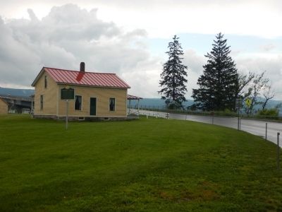
Location. 44° 2.149′ N, 73° 25.186′ W. Marker is in Addison, Vermont, in Addison County. Marker is at the intersection of Vermont Route 125 and Vermont Route 17, on the right when traveling east on State Route 125. Marker is located on grounds of Chimney Point Museum, just after crossing Champlain bridge. Touch for map. Marker is in this post office area: Vergennes VT 05491, United States of America. Touch for directions.
Other nearby markers. At least 8 other markers are within walking distance of this marker. Northern Terminal of the Crown Point Military Road (about 500 feet away, measured in a direct line); Samuel Champlain (approx. 0.4 miles away in New York); The White Flag (approx. half a mile away in New York); The 1929 Lake Champlain Bridge (approx. half a mile away in New York); Fort St. Frédéric (approx. half a mile away in New York); Selecting a Bridge Location (approx. half a mile away in New York); The French at Crown Point (approx. 0.6 miles away in New York); Eastern Terminus (approx. 0.6 miles away in New York).
Regarding Chimney Point. Chimney Point museum is open Wed-Sun (9:30am-5:30pm)
Credits. This page was last revised on November 3, 2020. It was originally submitted on July 13, 2015, by Kevin Craft of Bedford, Quebec. This page has been viewed 623 times since then and 42 times this year. Photos: 1, 2. submitted on July 13, 2015, by Kevin Craft of Bedford, Quebec. • Bill Pfingsten was the editor who published this page.

