Knossos in Irákleio, Crete, Greece — Ελλάδα (Southeastern Europe, Balkan Peninsula)
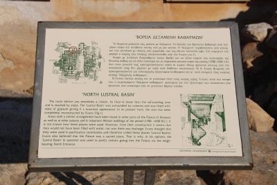
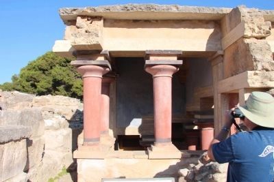
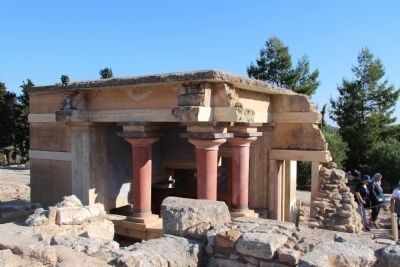
"North Lustral Basin"
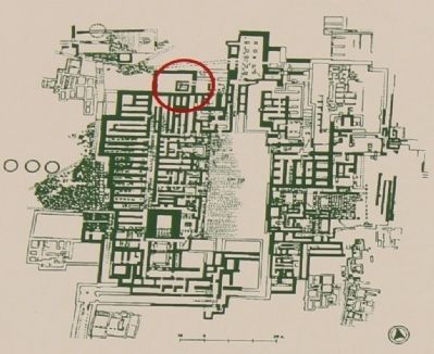
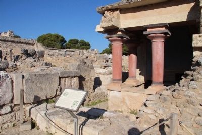
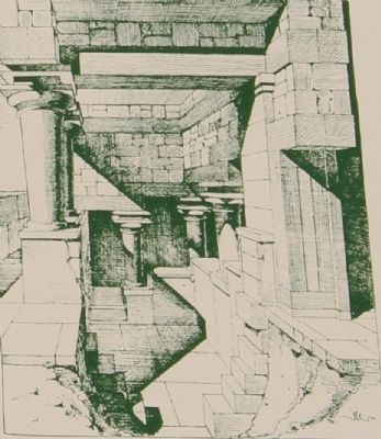
The room before you resembles a cistern. Its floor is lower than the surrounding area and is reached by steps. The "Lustral Basin" was surrounded by columns and was lined with slabs of gypsum giving it a luxurious appearance. In its present form, the area has been completely reconstructed by Evans (Figure 1).
Areas with a similar arrangement have been found in other parts of the Palace of Knossos, as well as at other palaces and in important Minoan buildings of the period (1700 - 1450 B.C.). It is not known how these places were used. However, from their construction it seems that they would not have been filled with water, nor was there any drainage. Evans thought that they were used in purification ceremonies and therefore called these places "Lustral Basins". Evans also believed that the Palace was a sacred place. That is why, in his opinion, the "Lustral Basin" in question was used to purify visitors going into the Palace via the neighboring North Entrance.
[Greek text:]
Το δωμάτιο μπροστά σας μοιάζει με δεςαμενή. Το δάπεδό του Βρίσκεται Βα8ύτερα από τον γύρω χώρο και κατέδαινε κανεις εκεί με μία σκάλα. Η "δεξαμενή" περιΒαλλόταν από κίονες και είχε επένδυση με πλάκες από γυψόλι8ο, που της έδιναν πολυτελή όψη. Στη σημερινή του μορφή ο χώρος έχει
πλήρως αποκαταστα8εί από τον Εναηs (ειιc.1). Χώροι με ανάλογη διαρρύ8μιση έχουν Βρε8εί και σε άλλα σημεία του ανακτόρου της Κνωσού, κα8ώς και σε άλλα ανάκτορα και σε σημαντικά μινωικά κτίρια της εποχής (1700-1450 π.Χ). Δεν είναι γνωστό πώς χρησιμοποιούνταν αυτοί οι χώροι. Όπως φαίνεται πάντως
από την κατασκευή τους δεν γέμιζαν με νερό ούτε διέθεταν αποχέτευση. Ο Α. Εναηs 8εώρησε ότι χρησιμοποιούνταν για τελετουργίες εςαγνισμού (καθαρμού) και γι' αυτό ονόμασε τους χώρους αυτούς "δεξαμενές καθαρμών". Ο Evans πίστευε επίσης ότι το ανάκτορο ήταν ένας χώρος ιερός. Γι'αυτό, κατά
την άποψή του, η συγκεκριμένη "δεξαμενή καθαρμών" χρησίμευε για τον εξαγνισμό των επισκεπτών που έμπαιναν στο ανάκτορο από τη γειτονική Βόρεια είσοδο.
Topics. This historical marker is listed in this topic list: Notable Places. A significant historical year for this entry is 1450.
Location. 35° 17.902′ N, 25° 9.784′ E. Marker is in Knossos, Crete, in Irákleio. Marker can be reached from Dedalou south of Glafkou, on the left when traveling south. This marker is located on the island of Crete, just south of the capital city of Heraklion, in the Palace of Knossos archaeological park, and you must be walking on the grounds of the archaeological park in oder to see this marker. Touch for map. Marker is in this post office area: Knossos, Crete 714 09, Greece. Touch for directions.
Other nearby markers. At least 8 other markers are within
walking distance of this marker. "Theatral Area", "Royal Road" (a few steps from this marker); North Entrance, North Pillar Hall (within shouting distance of this marker); "Throne Room" (within shouting distance of this marker); Conservation - restoration of the "West Magazines" (within shouting distance of this marker); West Wing (within shouting distance of this marker); Water and Drainage Conduits (within shouting distance of this marker); West Magazines (within shouting distance of this marker); "Piano Nobile" (within shouting distance of this marker). Touch for a list and map of all markers in Knossos.
Related markers. Click here for a list of markers that are related to this marker. To better understand the relationship, study each marker in the order shown.
Credits. This page was last revised on March 22, 2022. It was originally submitted on July 14, 2015, by Dale K. Benington of Toledo, Ohio. This page has been viewed 448 times since then and 20 times this year. Photos: 1, 2, 3, 4, 5, 6. submitted on July 14, 2015, by Dale K. Benington of Toledo, Ohio.
