Downtown in Baton Rouge in East Baton Rouge Parish, Louisiana — The American South (West South Central)
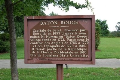
Baton Rouge
English translation:
Capital of the state. Named by Iberville in 1699 after the Indian name Iti Humma or "Baton Rouge". Village founded in 1721. Passed under the control of the English from 1763 to 1779 and the Spaniards from 1779 to 1810. It was part of the Republic of West Florida in 1810. Site of Louisiana State University.
Erected by Codefil & Commission de Tourisme.
Topics. This historical marker is listed in this topic list: Settlements & Settlers. A significant historical year for this entry is 1699.
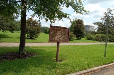
Location. 30° 27.362′ N, 91° 11.301′ W. Marker is in Baton Rouge, Louisiana, in East Baton Rouge Parish. It is in Downtown. Marker is on North 3rd Street south of State Capitol Drive, on the left when traveling south. Touch for map. Marker is in this post office area: Baton Rouge LA 70802, United States of America. Touch for directions.
Other nearby markers. At least 8 other markers are within walking distance of this marker. Battle Of Baton Rouge, 1862 (within shouting distance of this marker); Ole War Skule (within shouting distance of this marker); Pentagon Barracks (within shouting distance of this marker); The State Capitol (within shouting distance of this marker); Pentagon Buildings (within shouting distance of this marker); Capitol Building (about 300 feet away, measured in a direct line); First Air Mail Flight (about 300 feet away); Site of Spanish Fort (about 400 feet away). Touch for a list and map of all markers in Baton Rouge.
More about this marker. Same text both sides.
Credits. This page was last revised on February 12, 2023. It was originally submitted on July 17, 2015. This page has been viewed 551 times since then and 24 times this year. Photos: 1. submitted on July 17, 2015. 2. submitted on November 29, 2015. • Bernard Fisher was the editor who published this page.

