Near Guernsey in Platte County, Wyoming — The American West (Mountains)
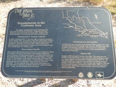
Encampments in the Guernsey Area
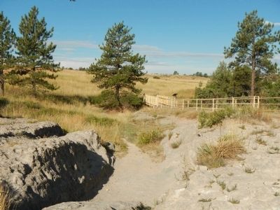
In 1842, Lieutenant John C. Fremont, led a mapping expedition of the Oregon Trail. According to Fremont's map maker, Charles Preuss, the flat area just below this sign is the most likely where the expedition camped on 21-22 July 1842. While camped here, Fremont noted in his report to Congress that Fort Larami would be a suitable place for a military post.
Many period documents describe this area as the Emigrant's Wash or Laundry Tub, due to the natural warm water temperature. Warm Springs is located approximately 1.25 miles to the west, up the drainage you are facing. In 1842, Lieutenant John C. Fremont wrote "At the distance of ten miles from the fort, we entered the sandy bed of a creek, a place where, on the left bank, a very large spring gushes with considerable noise and force out of the limestone. On the opposite side, a little below the spring, is a lofty limestone escarpment, partially shaded by a grove of large trees." Today, the site remains much the same.
Cold Springs Pass is located approximately three quarters of a mile and just to the left of the highest point you see. The Pass was used to get to Cold Spring Camp Site. The camp site is observable from a pull out on Highway 26 and is located approximately 2 miles west of Guernsey.
Register Cliff is located 2 miles to the East. The camp site was located on the flats below a mile long cliff of soft sandstone used as a name register by thousands of emigrants from 1847 on. It's interesting that no emigrant ever mentions inscribing names or initials on the cliff in diaries. Also located near Register Cliff was the War and Guerrier Trading Post (1852-1855), Mills and Janis Trading Post (1858-1860), and the Sandy Point Pony Express Station (1860-1861).
Erected by The Wyoming National Guard, in cooperation with the Advisory Council on Historic Preservation, U.S. Department of the Interior, Wyoming State Historic Preservation Office, ad Wyoming State Parks and Historic Sites.
Topics and series. This historical marker is listed in these topic lists: Roads & Vehicles • Settlements & Settlers. In addition, it is included in the Oregon Trail series list. A significant historical year for this entry is 1842.
Location. 42° 15.377′ N, 104° 45.009′ W. Marker is near Guernsey, Wyoming, in Platte County. Marker can be reached from Lucinda Rollins Road near South Guernsey Road, on the left when traveling west. Touch for map. Marker is in this post office area: Guernsey WY 82214, United States of America. Touch for directions.
Other nearby markers. At least 8 other markers are within walking distance of this marker. Forts, Stations, and Camps (about 400 feet away, measured in a direct line); The United States Army and the Oregon Trail (about 400 feet away); The US Army’s Role in Protecting the Oregon Trail is Best Described by the Soldiers (about 400 feet away); Oregon Trail Ruts (about 400 feet away); Oregon Trail Ruts State Historic Site (about 400 feet away); a different marker also named Oregon Trail Ruts (about 500 feet away); Grave of Lucindy Rollins (approx. 0.3 miles away); Laramie Peak (approx. one mile away). Touch for a list and map of all markers in Guernsey.
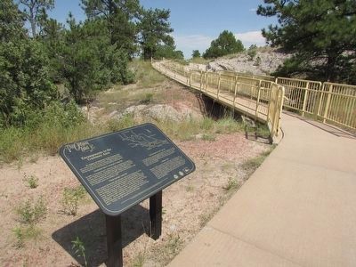
More about this marker. This marker is located in Oregon Trail Ruts State Historic Site near the bridge on the gravel trail leading from parking lot to the Oregon Trail Ruts.
Credits. This page was last revised on June 14, 2020. It was originally submitted on July 19, 2015, by Barry Swackhamer of Brentwood, California. This page has been viewed 590 times since then and 20 times this year. Photos: 1. submitted on July 19, 2015, by Barry Swackhamer of Brentwood, California. 2. submitted on August 9, 2015, by Bill Coughlin of Woodland Park, New Jersey. 3. submitted on July 19, 2015, by Barry Swackhamer of Brentwood, California. • Andrew Ruppenstein was the editor who published this page.


