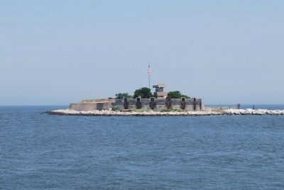
Rip Raps Island in Hampton, Virginia — The American South (Mid-Atlantic)
Fort Wool
Robert E. Lee
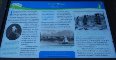
President Andrew Jackson contemplated fundamental changes to the bastion and apparently ordered alterations in its design. A frustrated Lee complained that "the President has played the devil with the plan for Fort Calhoun."
Lee's other duties were light and routine. He dealt with captains of vessels carrying stone to the island, which required examining the material for quality, size, and weight, followed by the filing of repetitious reports. He was also subjected to a bevy of bothersome inspections. During sweltering July temperatures, the Inspector General of the Army, Col. John E. Wool, arrived for yet another visit. Nettled by this redundancy, Lee hoped that Wool would enjoy his "dose of heated granite."
After two months at Fort Calhoun, and because of his good work, Lee was reassigned to Washington, where he was promoted to be assistant to the U.S. Army's Chief of Engineers.
Erected by VisitHampton.com and Virginia Civil War Trails.
Topics. This historical marker is listed in these topic lists: Forts and Castles • War, US Civil. A significant historical year for this entry is 1834.
Location. 36° 59.21′ N, 76° 18.128′ W. Marker is in Hampton, Virginia. It is on Rip Raps Island. THIS HISTORICAL MARKER IS NO LONGER ACCESSIBLE. Boats are not allowed to dock on the island. Touch for map. Marker is in this post office area: Norfolk VA 23503, United States of America. Touch for directions.
Other nearby markers. At least 8 other markers are within one mile of this marker, measured as the crow flies. A different marker also named Fort Wool (within shouting distance of this marker); Fort Monroe Concrete Seawall Eastern Terminus (approx. one mile away); Fort Monroe Seawall History (approx. one mile away); Fort Monroe History (approx. one mile away); Engineer Wharf (approx. one mile away); a different marker also named Fort Monroe Seawall History (approx. one mile away); First Africans in Virginia (approx. one mile away); Battery Irwin (approx. one mile away). Touch for a list and map of all markers in Hampton.
More about this marker. Fort Wool is on an uninhabited island. It can be seen from the Chesapeake Bay shore of Fort Monroe or from the Hampton Roads Bridge Tunnel (I-64). The island has been converted into a bird sanctuary and boats are prohibited from landing there.
Also see . . .
1. Fort Wool. This Hampton Parks page has some information on Fort Wool and states “The City of Hampton operated the historic fort as a park and historic attraction for years. However, it is now closed to tours and boaters.” (Submitted on May 16, 2023.)
2. Habitat Work at Fort Wool Completed. This link includes photographs of the conversion of Fort Wool to a bird habitat. Excerpts:
Over the last two months, DGIF and its contractors have converted Fort Wool on Rip Raps Island from a grassy, vegetated area to an open sandy nesting area for the seabird colony displaced from the Hampton Roads Bridge-Tunnel South Island. DGIF collaborated with U.S. Department of Agriculture-Wildlife Services to effect mammalian predator control, and our contractors removed all vegetation in the target nesting area.(Submitted on May 16, 2023.)
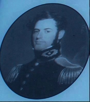
Barriers were set up at doorways and other openings to prevent chicks from entering into spaces that adult birds could not follow. Best practices defined by the Department of Historic Resources were followed; staff also created a steel plate box to protect an historicgrave marker on the island.Photographed By Brandon Fletcher, June 22, 20103. Robert E. LeeNewly married to the granddaughter of George Washington's wife, twenty-four-year-old 2nd Lt. of Army Engineers Robert E. Lee brought his bride Mary Custis to Old Point Comfort in the spring of 1831, where, as his older brother Charles Carter Lee wrote, "he and his bride would retreat to the walls and waves of Castle Calhoun."
Portrait, William E. West, 1838
Courtesy Washington and Lee University
Additional commentary.
1. Fort Wool is now closed.
Fort Wool closed to the public late in 2019 and was been converted to a bird sanctuary/bird colony to house gulls displaced by bridge construction.
Tour boats no longer go there, and private boats are not allowed to dock.
— Submitted May 12, 2023, by Evan Dwyer of Richmond, Virginia.
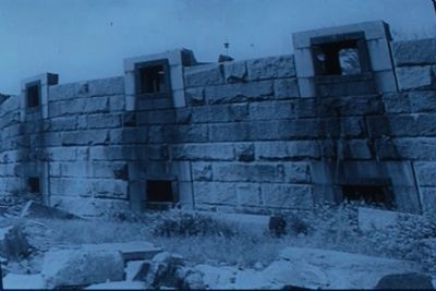
Photographed By Brandon Fletcher, June 22, 2010
4. Fort Wool
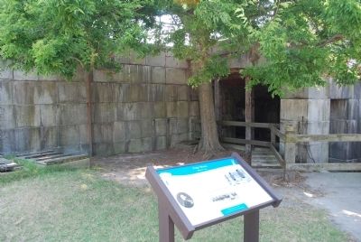
This exterior view of the west end of Fort Wool shows the original case-mates' tightly fitted massive granite blocks, gun embrasures, and differently shaded granite. Lee place the load stone, to settle the island, on this ground and elsewhere. Photograph 2009 - Courtesy David K. Hazzard
Credits. This page was last revised on May 16, 2023. It was originally submitted on July 23, 2015, by Brandon Fletcher of Chattanooga, Tennessee. This page has been viewed 550 times since then and 25 times this year. Photos: 1, 2, 3, 4, 5, 6. submitted on July 23, 2015, by Brandon Fletcher of Chattanooga, Tennessee. • Bernard Fisher was the editor who published this page.
