Berea in Madison County, Kentucky — The American South (East South Central)
Richmond-Prelude/ Richmond Battle
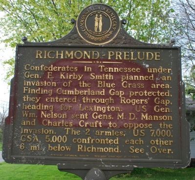
Richmond-Prelude
Confederates in Tennessee under Gen. E. Kirby Smith planned an invasion of the Blue Grass area. Finding Cumberland Gap protected, they entered through Rogers' Gap, heading to Lexington. US Gen. Wm. Nelson sent Gens. M.D. Manson and Charles Cruft to oppose the invasion. The 2 armies, US 7,000, CSA 5,000 confronted each other 6 mi. below Richmond. See Over.
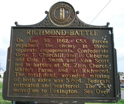
Richmond-Battle
On Aug. 30, 1862, CSA forces repulsed the enemy in three separate engagements. Confederate Gens. T. Churchill and P. Cleburne and Cols. P. Smith and John Scott led in battles at Mt. Zion Church, White's Farm, and at Richmond. The total dead, wounded, missing of both sides was 5,804. Federals retreated and scattered. The CSA moved on to Lexington. See Over.
Erected 1969 by Kentucky Historical Society and Kentucky Department of Highways. (Marker Number 1300.)
Topics and series. This historical marker is listed in this topic list: War, US Civil. In addition, it is included in the Kentucky Historical Society series list. A significant historical month for this entry is August 1794.
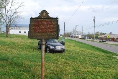
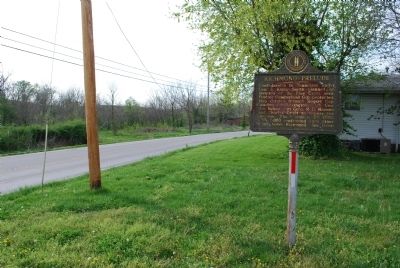
Location. 37° 38.996′ N, 84° 14.468′ W. Marker is in Berea, Kentucky, in Madison County. Marker is on Battlefield Memorial Highway (U.S. 421) north of Old Kingsto-Berea Raod, on the right when traveling north. Touch for map. Marker is in this post office area: Berea KY 40403, United States of America. Touch for directions.
Other nearby markers. At least 8 other markers are within 2 miles of this marker, measured as the crow flies. The Battle Begins (approx. half a mile away); General Thomas Churchill (approx. 1.1 miles away); In Honor and Remembrance (approx. 1.1 miles away); Battle of Richmond (approx. 1.1 miles away); a different marker also named The Battle of Richmond (approx. 1.1 miles away); Slavery at Pleasant View Farm (approx. 1.1 miles away); Churchill's Draw (approx. 1.2 miles away); Texas Memorial (approx. 1.2 miles away).
Also see . . . Civil War Trust. The Battle of Richmond (Submitted on July 24, 2015, by Brandon Fletcher of Chattanooga, Tennessee.)
Additional keywords. The Battle of Richmond, Kirby Smith, Churchill, Patrick Cleburne, Nelson, Manson, Cruft. Aug 30, 1862.
Credits. This page was last revised on November 3, 2020. It was originally submitted on July 24, 2015, by Brandon Fletcher of Chattanooga, Tennessee. This page has been viewed 585 times since then and 41 times this year. Last updated on October 1, 2019, by Bradley Owen of Morgantown, West Virginia. Photos: 1, 2, 3, 4. submitted on July 24, 2015, by Brandon Fletcher of Chattanooga, Tennessee. • J. Makali Bruton was the editor who published this page.


