Prairieville in Ascension Parish, Louisiana — The American South (West South Central)
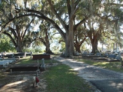
Prairieville Cemetery
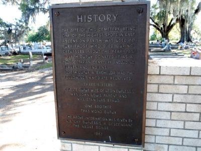
History
Joseph Dupuy, a bachelor, had the following immediate relatives:
Celeste Dupuy, wife of Leon Duplessis,
Mrs. John Parent, and
Mrs. Stanislas Braud.
One brother
Trasimond Dupuy
The above information was given by L.B. "Cap" Duplessis, a descendent of the above donor.
Erected 1967.
Topics. This historical marker is listed in these topic lists: Cemeteries & Burial Sites • Settlements & Settlers. A significant historical year for this entry is 1785.
Location. 30° 17.461′ N, 90° 58.472′ W. Marker is in Prairieville, Louisiana, in Ascension Parish. Marker is on Duplessis Road, 0.2 miles east of Old Jefferson Highway (Louisiana Highway 73), on the right when traveling east. Touch for map. Marker is in this post office area: Prairieville LA 70769, United States of America. Touch for directions.
Other nearby markers. At least 8 other markers are within 6 miles of this marker, measured as the crow flies. The Ascension Parish Negro Fair Association, Inc. / Ascension Parish Negro Fairgrounds (approx. 0.9 miles away); Bayou Manchac (approx. 3.8 miles away); William Bartram Trail (approx. 4.3 miles away); Viet Nam/ Desert Storm Memorial (approx. 5.6 miles away); Cal Ripken, Sr. (approx. 5.6 miles away); Civil War (approx. 5.7 miles away); a different marker also named The Civil War (approx. 5.7 miles away); a different marker also named Civil War (approx. 5.7 miles away).
Credits. This page was last revised on March 31, 2024. It was originally submitted on July 25, 2015. This page has been viewed 690 times since then and 38 times this year. Photos: 1, 2. submitted on July 25, 2015. • Bernard Fisher was the editor who published this page.

