Cody in Park County, Wyoming — The American West (Mountains)
Colterís Hell & Extinct Geyser Basin
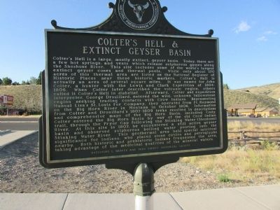
Colterís Hell is a large, mostly extinct, geyser basin. Today, there are a few hot springs, and vents which release sulphurous gasses along the Shoshone River. This site includes some of the worldís largest extinct geyser cones and thermal pools. While only about 170 acres of this thermal area are listed on the National Register of Historic Places near these historic markers. Colterís Hell is actually an area of several square miles. It was named for John Colter, a hunter with the Lewis and Clark Expedition of 1804-1806. When Colter later described the volcanic region, others called it Colterís Hell in disbelief. Afterward, Colter and expedition interpreter, George Drouillard, entered the wild, unknown Yellowstone region seeking trading contacts with Crow Indians. Representing Manual Lisaís St. Louis Fur Company, they operated from Ft. Raymond on the Big Horn River in Montana in October 1806. Information from Colter and Drouillardís 1807-1809 treks resulted in descriptions and comprehensive maps of the Big Horn basin, including Cody. Colter entered the Big Horn Basin by way of the old Crow Indian trail, through the Pryor Gap following the Stinking Water (Shoshone) River. At this site in 1807, he encountered a still active geyser basin and observed sulphurous boiling water pouring into the Stinking Water River. This geothermal area held special spiritual significance for Indians, who placed stone circles and petroglyphs nearby. Both historic and prehistoric Indians frequented the area, taking advantage of the medicinal qualities of the mineral waters.
Erected by City of Cody Historic Preservation Commission.
Topics. This historical marker is listed in this topic list: Natural Features. A significant historical month for this entry is October 1806.
Location. 44° 30.825′ N, 109° 6.309′ W. Marker is in Cody, Wyoming, in Park County. Marker is on W Yellowstone Avenue (U.S. 20) west of Demaris Drive, on the right when traveling west. Touch for map. Marker is in this post office area: Cody WY 82414, United States of America. Touch for directions.
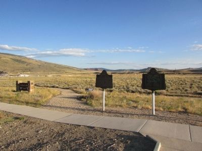
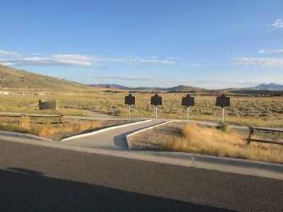
Other nearby markers. At least 8 other markers are within walking distance of this marker. Indian Names for Land Features (here, next to this marker); Old Cody City & Buffalo Bill Codyís Town in the Rockies (here, next to this marker); The Panoramic View (a few steps from this marker); Cedar Mountain (within shouting distance of this marker); Trail to Old Cody City (about 400 feet away, measured in a direct line); Belle Drewry (about 500 feet away); Lee Street Ė Cody City (about 500 feet away); W.A. Gallagher and Blind Bill (about 500 feet away). Touch for a list and map of all markers in Cody.
Credits. This page was last revised on June 16, 2016. It was originally submitted on July 25, 2015, by Bill Coughlin of Woodland Park, New Jersey. This page has been viewed 837 times since then and 42 times this year. Photos: 1, 2, 3. submitted on July 25, 2015, by Bill Coughlin of Woodland Park, New Jersey.


