Saugus in Essex County, Massachusetts — The American Northeast (New England)
Making Iron
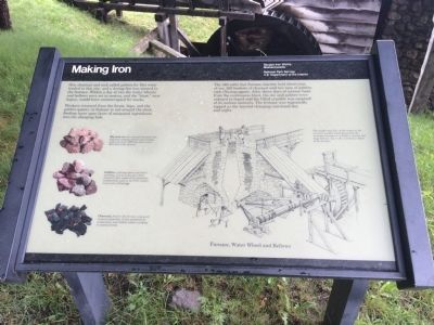
Workers returned from the forest, bogs, and the gabbro quarry at Nahant to toil around the clock, feeding layer upon layer of measured ingredients into the charging hole.
The 340 cubic foot furnace interior held three tons of ore, 265 bushels of charcoal and two tons of gabbro rock (fluxing agent). After three days of intense heat from the continuous blast, the ore and gabbro were reduced to liquid and the filled crucible was emptied of its molten contents. The furnace was repeatedely tapped as the layered charging continued day and night.
Captions:
Bog iron ore (the mineral limonite) was dug from stagnant ponds and swamps; each year up to 1000 tons of ore were delivered to the furnace.
Gabbro, a fluxing agent and aid to smelting, was an innovative local discovery that replaced the limestone traditionally used in the 17th century ironworks of England.
Charcoal, fuel for the furnace, was used in great quantities. It was produced by woodcutters and skilled colliers working in nearby forests.
The weight and flow of the water in the overshot wooden wheel generated the constant horsepower needed to operate the huge bellows, key to the continuous blast of the furnace.
Furnace, Water Wheel and Bellows
Topics. This historical marker is listed in these topic lists: Industry & Commerce • Settlements & Settlers.
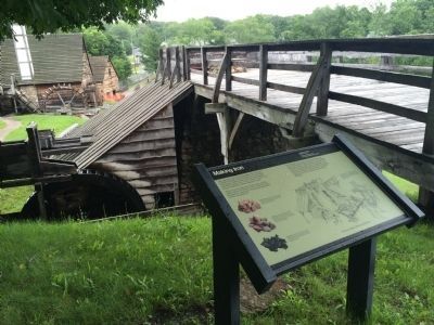
Location. 42° 28.145′ N, 71° 0.505′ W. Marker is in Saugus, Massachusetts, in Essex County. Marker can be reached from Bridge Street. The marker is at the Saugus Iron Works National Historic Site, on the walkway to the reconstructed smelting furnace. Touch for map. Marker is in this post office area: Saugus MA 01906, United States of America. Touch for directions.
Other nearby markers. At least 8 other markers are within walking distance of this marker. The Casting House (within shouting distance of this marker); River Basin Terminus (within shouting distance of this marker); The Forge (within shouting distance of this marker); Blacksmith Shop (about 400 feet away, measured in a direct line); Appleton's Pulpit (approx. 0.2 miles away); Saugus Vietnam Memorial (approx. ¼ mile away); Saugus Massachusetts World War I Honor Roll (approx. ¼ mile away); Saugus Korea/Vietnam Memorial (approx. 0.3 miles away). Touch for a list and map of all markers in Saugus.
Credits. This page was last revised on June 16, 2016. It was originally submitted on July 26, 2015, by J. Makali Bruton of Accra, Ghana. This page has been viewed 295 times since then and 18 times this year. Photos: 1, 2, 3. submitted on July 26, 2015, by J. Makali Bruton of Accra, Ghana. • Bill Pfingsten was the editor who published this page.


