Quality Hill in Kansas City in Jackson County, Missouri — The American Midwest (Upper Plains)
Etienne Veniard - Sieur de Bourgemont
Etienne Veniard - Sieur de Bourgemont
Inscription.
(front of marker in English)
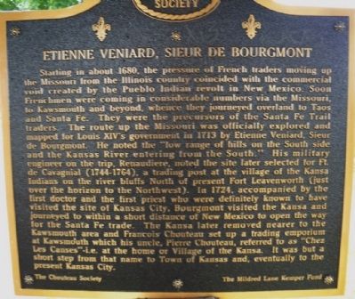
Starting about 1680, the pressure of French traders moving up the Missouri from the Illinois country coincided with the commercial void created by the Pueblo Indian revolt in New Mexico. Soon, Frenchmen were coming in considerable numbers via the Missouri, to Kawsmouth and beyond, whence they journeyed overland to Taos and Santa Fe. They were the precursors of the Santa Fe Trail traders. The route up the Missouri was officially explored and mapped for Louis XIV’s government in 1713 by Etienne Veniard, Sieur de Bourgmont. He noted the “low range of hills on the South side and the Kansas River entering from the South.” His military engineer on the trip, Renaudiere, noted the site later selected for Ft’ de Cavagnial (1744-1764), a trading post at the village of the Kansa Indians on the river bluffs North of present Fort Leavenworth (just over the horizon to the Northwest). In 1724, accompanied by the first doctor and he first priest who were definitely known to have visited the site of Kansas City, Bourgmont visited the Kansa and journeyed to within a short distance of New Mexico to open the way for the Santa Fe trade. The Kansa later removed nearer to the Kawsmouth area and Francois Chouteau set up a trading emporium at Kawsmouth which his uncle, Pierre Chouteau, referred to as “Chez Les Canses”-i.e. at the home or Village of the Kansa. It was but a short step from that name to Town of Kansas and, eventually to the present Kansas City.
(Reverse of marker in French)
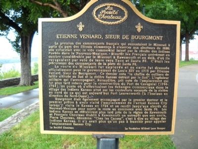
La route du Missouri fut explorée et sa carte fut dressée officiellement pour le gouvernement de Louis XIV en 1713 par Etienne Veniard, Sieur de Bourgemont. Ce dernier nota “la chaîne de collines de faible altitude au Sud et la rivière Kansas entrant par le Sud”. L’ingénieur militaire qui l’accompagnait, Renaudière, prit note de l’emplacement qui fut plus tard retenu pour la construction du Fort Cavagnial (1744 – 1764), un poste où s’effectuaient les échanges
commerciaux dans le village des Indiens Kansas situé sur les contreforts escarpés de la rivière au nord de ce qui est aujord’hui Fort Leavenworth (à l’horizon en direction du Nord-Ouest).
Bourgmont était également accompagné par le premier docteur et le premier prêtre à avoir visité l’emplacement de l’actuel Kansas City lorsqu’il visita le Kansas en 1724 et se rendit jusqu’aux abords du Nouveaux-Mexique pour ouvrir la route au commerce avec Santa Fé. Les Indiens Kansas se réétablirent plus tard pres de la région de Kawsmouth et Francois Chouteau établit à Kawsmouth un entrepôt que son oncle, Pierre Chouteau, dénomma: “Chez les Canses”, c’est à dire au village des Indiens Kansas. Il n’y avait plus qu’un pas à franchir pour appeler l’emplacement Kansas City.
Erected by Chouteau Society & the Mildred Lane Kemper Fund.
Topics. This historical marker is listed in these topic lists: Colonial Era • Exploration • Native Americans • Settlements & Settlers. A significant historical year for this entry is 1680.
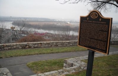
Location. 39° 6.303′ N, 94° 35.543′ W. Marker is in Kansas City, Missouri, in Jackson County. It is in Quality Hill. Marker is at the intersection of 8th Street and Jefferson Street, on the right when traveling west on 8th Street. Touch for map.
Marker is at or near this postal address: 611 W 8th Street, Kansas City MO 64105, United States of America. Touch for directions.
Other nearby markers. At least 8 other markers are within walking distance of this marker. Lewis and Clark Expedition Across Missouri (a few steps from this marker); The French and the Lewis & Clark Expedition (within shouting distance of this marker); Lewis and Clark (within shouting distance of this marker); James Pendergast (within shouting distance of this marker); Darby Trotter Spirit Mall (about 700 feet away, measured in a direct line); Frontier Railroads in Kansas City (about 800 feet away); Ed Hogan (approx. 0.2 miles away); Chez Les Canses or "Chouteau's" (approx. 0.2 miles away). Touch for a list and map of all markers in Kansas City.
More about this marker. Parking may be at a premium during business hours. This marker is the one to the far left.
Also see . . .
1. Discovering Lewis & Clark. Website from the Fort Mandan Foundation with resources about the expedition. (Submitted on February 7, 2010, by Thomas Onions of Olathe, Kansas.)
2. Lewis & Clark Trail. Website from the National Park Service. (Submitted on February 7, 2010, by Thomas Onions of Olathe, Kansas.)
3. Case Park. Information from Lewis & Clark Trail on Case Park (Submitted on February 7, 2010, by Thomas Onions of Olathe, Kansas.)
Credits. This page was last revised on February 10, 2023. It was originally submitted on February 7, 2010, by Thomas Onions of Olathe, Kansas. This page has been viewed 2,126 times since then and 355 times this year. Last updated on July 26, 2015, by Michael W. Kruse of Kansas City, Missouri. Photos: 1, 2, 3. submitted on February 7, 2010, by Thomas Onions of Olathe, Kansas. • Bill Pfingsten was the editor who published this page.


