Hometown in Putnam County, West Virginia — The American South (Appalachia)
Coal Mining in Putnam County
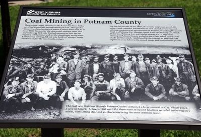
The earliest export industry of the Kanawha River Valley revolved around the manufacturing of salt. Though the discovery of coal veins in Putnam County dates back to at least 1800, for most of the nineteenth century these coal deposits supplied only limited amounts of coal for the region's salt furnaces and for the steamboats on the river. Commercial mining did not take hold in Putnam County until the end of the nineteenth century.
By the first decade of the 1900s, the county employed over 1,000 miners and exported 400,000 tons of coal in peak years. Several mining companies set up operation in Putnam, including Plymouth Coal and Mining Co., Marmet-Smith Coal and Mining Co., Black Betsy Coal Mining Co., and Alpha Mining Co. Large-scale mining in Putnam County ended in the 1940s, when rising costs made profits vanish. Additionally, the coming of World War II siphoned away labor to the armed forces and to munitions plants.
The coal vein that runs through Putnam County contained a large amount of clay, which posed a cave-in hazard. Between 1900 and 1924, there were at least 53 fatalities recorded in the region’s mines, with falling slate and electrocution being the most common cause.
Erected by West Virginia Humanities Council's Rivers to Ridges Heritage Trail.
Topics. This historical marker is listed in this topic list: Industry & Commerce. A significant historical year for this entry is 1800.
Location. 38° 31.729′ N, 81° 51.447′ W. Marker is in Hometown, West Virginia, in Putnam County. Marker is on Charleston Road (West Virginia Route 62) south of A Street when traveling south. It is in Hometown Park. Touch for map. Marker is in this post office area: Hometown WV 25109, United States of America. Touch for directions.
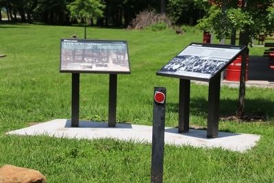
Other nearby markers. At least 8 other markers are within 2 miles of this marker, measured as the crow flies. A Park for the Coal Miner (here, next to this marker); Andrew & Charles Lewis March (within shouting distance of this marker); George Washington (within shouting distance of this marker); Washington’s Land (within shouting distance of this marker); Kanawha Valley Drag Strip (approx. ¾ mile away); Historic Hoge House (approx. 1.8 miles away); The Civil War in Putnam County (approx. 1.8 miles away); Putnam County War Memorial (approx. 1.9 miles away). Touch for a list and map of all markers in Hometown.
Also see . . . Coal Mining Was Once a Profitable Business in Putnam. 2014 article by Bill Ellis in the Huntington Herald-Dispatch. Excerpt: “My Dad was a ‘car whacker’ for both the Truax-Trayer Coal Company at United, one more mile up the creek, and for the Carbon Fuel Coal Company Number 9 mine at Wevaco Coal cars used in the mines would be in wrecks, bumped hard or wear out from constant use and rough treatment. To repair those damaged cars took a lot of hard licks with a strong steel hammer. The car whacker used his big hammer, chisels and crow bar every day. A mashed thumbnail was more common than unusual. It seemed to me that Dad usually had one. It was not easy work.” (Submitted on July 26, 2015.)
Credits. This page was last revised on January 5, 2022. It was originally submitted on July 26, 2015, by J. J. Prats of Powell, Ohio. This page has been viewed 1,298 times since then and 138 times this year. Photos: 1, 2. submitted on July 26, 2015, by J. J. Prats of Powell, Ohio.

