Near Fairlawn in Pulaski County, Virginia — The American South (Mid-Atlantic)
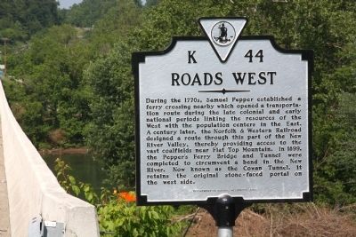
Roads West
Erected 2009 by Department of Historic Resources. (Marker Number K-44.)
Topics and series. This historical marker is listed in this topic list: Railroads & Streetcars. In addition, it is included in the Virginia Department of Historic Resources (DHR) series list. A significant historical year for this entry is 1899.
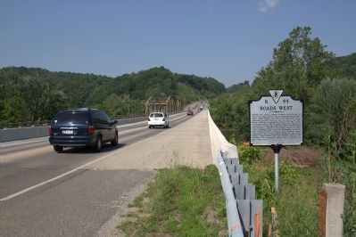
Location. 37° 9.636′ N, 80° 33.227′ W. Marker is near Fairlawn, Virginia, in Pulaski County. Marker is on Peppers Ferry Road near the New River Bridge (Virginia Route 114), on the right when traveling east. Touch for map. Marker is in this post office area: Radford VA 24141, United States of America. Touch for directions.
Other nearby markers. At least 8 other markers are within 2 miles of this marker, measured as the crow flies. Montgomery County / Pulaski County (here, next to this marker); Radford (approx. 1.4 miles away); Native American Village Site (approx. 1.7 miles away); Lovely Mount Baptist Church (approx. 1.7 miles away); High Water Mark (approx. 1.8 miles away); Starnes (approx. 1.9 miles away); The New River (approx. 1.9 miles away); a different marker also named Montgomery County / Pulaski County (approx. 1.9 miles away).
Regarding Roads West. Norfolk Southern raised the ceiling on the Cowan Tunnel and 27 other tunnels and removed 24 overhead obstacles—completing this work in 2010—to allow for double-stacked freight trains to travel between the Port of Virginia in Norfolk and Columbus Ohio and other points in the Midwest.
During the early and mid 20th century, The Norfolk & Western Railroad’s Norfolk to Cincinnati passenger trains ran through this tunnel, including the Powhatan Arrow and the Cavalier. The Tennessean from Washington to Memphis, operated jointly with the Southern Railway, also ran through this tunnel.
Credits. This page was last revised on June 16, 2016. It was originally submitted on June 5, 2011, by J. J. Prats of Powell, Ohio. This page has been viewed 736 times since then and 62 times this year. Last updated on July 26, 2015, by J. Makali Bruton of Accra, Ghana. Photos: 1, 2. submitted on June 5, 2011, by J. J. Prats of Powell, Ohio. • Bill Pfingsten was the editor who published this page.

