Near Gardendale in Ector County, Texas — The American South (West South Central)
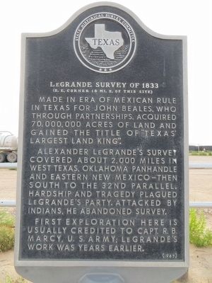
LeGrande Survey of 1833
(S.E. Corner 18 mi. E. of this site)
Alexander LeGrande's survey covered about 2,000 miles in west Texas, Oklahoma Panhandle and Eastern New Mexico then south to the 32nd parallel. Hardship and tragedy plagued LeGrande's party. Attacked by Indians, he abandoned survey.
First exploration here is usually credited to Capt. R. B. Marcy, U.S. Army; LeGrande's work was years earlier.
Erected 1967 by State Historical Survey Committee. (Marker Number 3055.)
Topics. This historical marker is listed in this topic list: Exploration.
Location. 32° 1.263′ N, 102° 25.737′ W. Marker is near Gardendale, Texas, in Ector County. Marker is at the intersection of U.S. 385 and Texas Highway 158, on the right when traveling north on U.S. 385. Touch for map. Marker is in this post office area: Gardendale TX 79758, United States of America. Touch for directions.
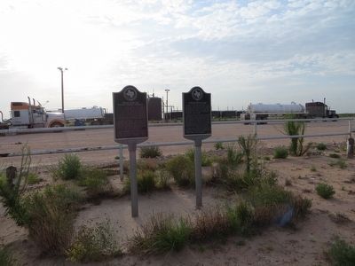
Other nearby markers. At least 8 other markers are within 10 miles of this marker, measured as the crow flies. Near site of Baker Ranch School (here, next to this marker); Emigrant Trail (approx. 7.8 miles away); West Texas Relays (approx. 8.1 miles away); El Paso Natural Gas Company's First Compressor Transmission Engine (approx. 9.6 miles away); The Cable Tool Rig (approx. 9.7 miles away); Permian Basin Oil Show (approx. 9.8 miles away); Permian Basin Fair & Exposition (approx. 9.8 miles away); Odessa Chuck Wagon Gang (approx. 9.8 miles away).
Credits. This page was last revised on June 16, 2016. It was originally submitted on July 27, 2015, by Bill Kirchner of Tucson, Arizona. This page has been viewed 461 times since then and 52 times this year. Photos: 1, 2. submitted on July 27, 2015, by Bill Kirchner of Tucson, Arizona. • Bernard Fisher was the editor who published this page.

