Salem in Essex County, Massachusetts — The American Northeast (New England)
Derby Wharf
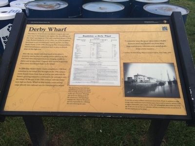
After the war, Hasket inherited much of his fatherís property, and his fleet of trading vessels sailed to the Far East and other international ports, bringing wealth to Salem and its merchants. Cargoes were stored in spacious three-story warehouses built on the wharf.
In 1806 Elias Hasket Derbyís heirs completed a 1300 foot extension to the wharf, and throughout the 19th century exotic luxury items from Asia as well as raw materials for Salemís growing industries continued to be unloaded onto the wharf. At the end of the 19th century, railroad tracks were laid on Derby Wharf so that vessels could unload cargo directly into railroad cars for transportation inland.
I remember now the queer spicy indescribable Eastern smell that floated out from those huge warehouses, wherein were stored spoils from every countryÖ” - Caroline Howard King, When I Lived in Salem, 1822-1866, 1937
Captions:
This sheet listing wharf fees and regulations was posted here about 1823. Fees for docking were based on the size of the vessel. Wharfage was the fee for storing goods in the warehouses. The wharfinger managed the wharf for its owners, and was responsible for collecting fees and enforcing the rules.
At one time, as many as fifteen warehouses lined Derby Wharf. In addition to cargo storage, many warehouses had workshop space that would be leased to artisans such as riggers, blacksmiths, and coopers. In this 1887 photograph, taken at the end of the age of sail, you can see that one sailmaker still has a workshop on the second floor of the first warehouse on the wharf.
Erected by National Park Service.
Topics. This historical marker is listed in these topic lists: Colonial Era • Industry & Commerce • Waterways & Vessels. A significant historical year for this entry is 1762.
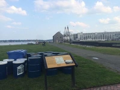
Location. 42° 31.279′ N, 70° 53.213′ W. Marker is in Salem, Massachusetts, in Essex County. Marker is at the intersection of Derby Street and Orange Street, on the right when traveling east on Derby Street. This marker is at Salem Maritime National Historic Site. Touch for map. Marker is at or near this postal address: 177 Derby Street, Salem MA 01970, United States of America. Touch for directions.
Other nearby markers. At least 8 other markers are within walking distance of this marker. The Custom House (a few steps from this marker); Wharves in the late 1800's (within shouting distance of this marker); Derby House (within shouting distance of this marker); Home for Aged Women (within shouting distance of this marker); West India Goods Store (within shouting distance of this marker); The Hawkes House (within shouting distance of this marker); Wharves in the Early 1800s (within shouting distance of this marker); Central Wharf (within shouting distance of this marker). Touch for a list and map of all markers in Salem.
Credits. This page was last revised on April 20, 2023. It was originally submitted on July 31, 2015, by J. Makali Bruton of Accra, Ghana. This page has been viewed 428 times since then and 12 times this year. Photos: 1, 2. submitted on July 31, 2015, by J. Makali Bruton of Accra, Ghana. 3. submitted on April 18, 2023, by Craig Doda of Napoleon, Ohio. • Bill Pfingsten was the editor who published this page.


