Antioch Acres in Kansas City in Clay County, Missouri — The American Midwest (Upper Plains)
Antioch Church
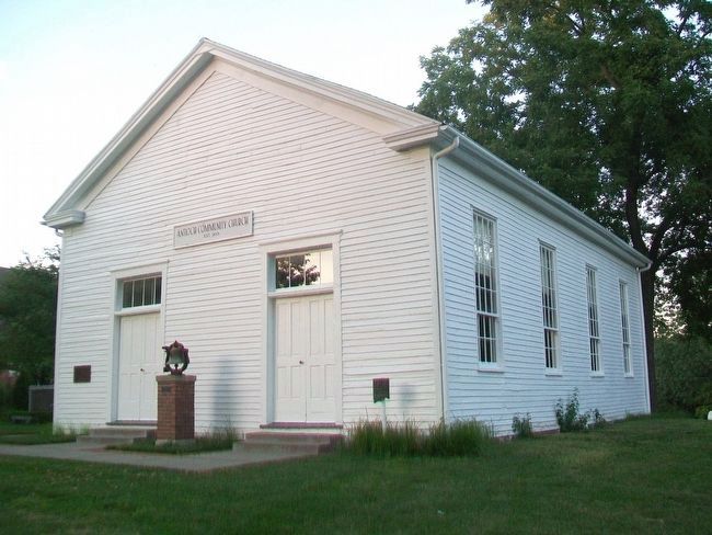
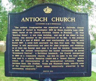
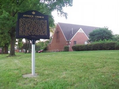
"The Antioch Congregation was organized as a Christain Church (Disciples of Christ) in September 1853 by Moses Easterly Lard (1818-1880), Pastor of the Liberty Christain [sic] Church in Missouri. Its first 'Meeting House', a one room building, and one of the oldest in Clay County, was peculiar to the architecture of the day. It was erected in 1859 at a cost of $1800 and used continuously for worship until Easter 1957. A newly built sanctuary was then first used. The 'Meeting House' is still maintained and used for some programs and weddings; on at least one Sunday each year it is used for worship. Commencing in 1885, the Antioch congregation has hosted continuously an annual 'Strawberry Festival'. A Northland Landmark, the Church reorganized in 1930 as a Community Church, has lent its name to the road which runs past it, a nearby Shopping Center and a 'School District' middle school, all representative of its geographical influence. Nearby Davidson Road, like Prather, Vivion and Winnwood Roads, identify some of the congregation's family names historically preserved in the surrounding community."
Erected 2003 by Native Sons and Daughters of Greater Kansas City.
Topics and series. This historical marker is listed in these topic lists: Churches & Religion • Settlements & Settlers. In addition, it is included in the Kansas City - Native Sons and Daughters of Greater Kansas City series list. A significant historical month for this entry is September 1853.
Location. 39° 10.864′ N, 94° 32.928′ W. Marker is in Kansas City, Missouri, in Clay County. It is in Antioch Acres. Marker is at the intersection of NE Antioch Road (Missouri Route 1) and NE 48th Street, on the right when traveling north on NE Antioch Road. Touch for map. Marker is at or near this postal address: 4805 NE Antioch Road, Kansas City MO 64119, United States of America. Touch for directions.
Other nearby markers. At least 8 other markers are within 4 miles of this marker, measured as the crow flies. A different marker also named Antioch Church (a few steps from this marker); a different marker also named Antioch Church (a few steps from this marker); Replica of the Statue of Liberty (approx. 2.8 miles away); War Memorial (approx. 2.8 miles away); a different marker also named War Memorial (approx. 2.8 miles away); Crowley Cemetery (approx. 3.1 miles away); Curran Park (approx. 3.2 miles away); Renner Village Site (approx. 3.6 miles away). Touch for a list and map of all markers in Kansas City.

Photographed By William Fischer, Jr., July 29, 2015
3. Antioch Church, c.1859
Church website homepage:
Click for more information.
Click for more information.
Credits. This page was last revised on February 10, 2023. It was originally submitted on August 2, 2015, by William Fischer, Jr. of Scranton, Pennsylvania. This page has been viewed 492 times since then and 24 times this year. Photos: 1, 2, 3. submitted on August 2, 2015, by William Fischer, Jr. of Scranton, Pennsylvania.

