Near Midland in Midland County, Texas — The American South (West South Central)
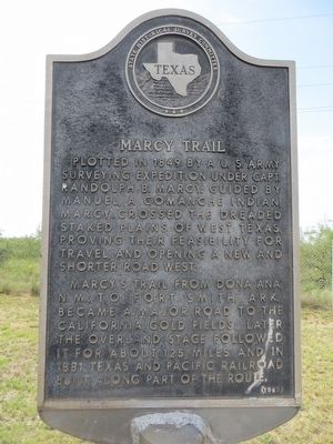
Marcy Trail
Marcy's trail from Dona Ana, N. M., to Fort Smith, Ark., became a major road to the California gold fields. Later the overland stage followed it for about 125 miles and in 1881, Texas and Pacific Railroad built along part of the route.
Erected 1967 by State Historical Survey Committee. (Marker Number 3206.)
Topics. This historical marker is listed in this topic list: Exploration. A significant historical year for this entry is 1849.
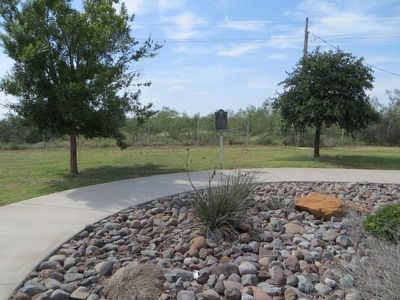
Location. 32° 0.942′ N, 102° 0.107′ W. Marker is near Midland, Texas, in Midland County. Marker is on Interstate 20, 1.4 miles west of Texas Highway 250, on the right when traveling west. Marker is in west bound rest area. Touch for map. Marker is in this post office area: Midland TX 79706, United States of America. Touch for directions.
Other nearby markers. At least 8 other markers are within 5 miles of this marker, measured as the crow flies. Midland County (about 600 feet away, measured in a direct line); Brown-Dorsey House (approx. 4.3 miles away); John Valentine Pliska (approx. 4.4 miles away); Midland's First House (approx. 4.4 miles away); Site of “The Staked Plains” (approx. 4.4 miles away); Former Site of Midland National Bank (approx. 4.4 miles away); Site of Midland County's First Bank (approx. 4.4 miles away); The Yucca Theatre (approx. 4˝ miles away). Touch for a list and map of all markers in Midland.
Credits. This page was last revised on June 16, 2016. It was originally submitted on August 3, 2015, by Bill Kirchner of Tucson, Arizona. This page has been viewed 505 times since then and 36 times this year. Photos: 1, 2, 3. submitted on August 3, 2015, by Bill Kirchner of Tucson, Arizona. • Bernard Fisher was the editor who published this page.


