Crow Agency in Big Horn County, Montana — The American West (Mountains)
Deep Ravine
Little Bighorn Battlefield
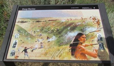
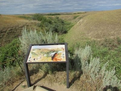
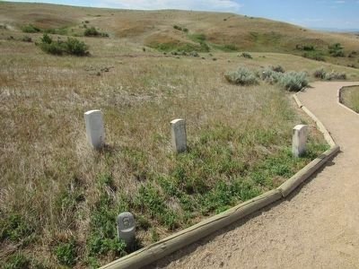
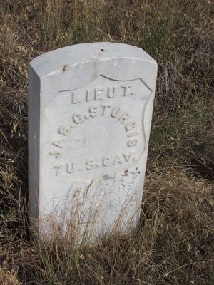
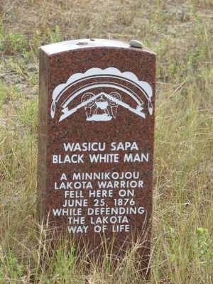
Deep Ravine (Crazy Horse Gully & Grey Horse Ravine) was the scene of fierce fighting during the battle. Crazy Horse, and other Sioux and Cheyenne warriors crossed the Little Bighorn River (in front of you) and rode up the ravine during the attack against Lt. Col. George A. Custer’s Battalion. Toward the end of the battle, approximately 40 soldiers broke out from Last Stand Hill, and were killed here, and on adjacent ridges. Warrior accounts indicate that a Sioux, was also killed during the fighting and a Northern Cheyenne mortally wounded (they were recovered by their families). Approximately 28 soldiers, (mostly from Company E) were found in a large heap near the head of the ravine, and others at 15 yard intervals below.
Army accounts indicate that the soldiers in the ravine were buried where they fell. Historical evidence suggests that the soldiers in the ravine were overlooked during the reburial in the mass grave on Last Stand Hill in 1881.
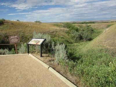
Attempts in 1984, 1985, and 1989 to locate the remains of the missing soldiers using modern archeological techniques and equipment failed. However, in 1995 and 1996 a Rapid Geophysical Surveyor Investigation indicated soil anomalies and metal, detected throughout the ravine, especially in the upper two-thirds area near the headwall (below you). Perhaps future archeological investigations and techniques may one-day solve the mystery of the missing 7th Cavalrymen.
“In the gully men were lying on top of each other. I could see where they ran down one side and tried to scramble up the other.”
Co. A, 7th Cavalry
“In the ravine I found most of the troop, (Co. E) who had used the upper sides for a kind of breastwork, falling to the bottom as they were shot down . . . In burying the men the stench was so great . . . so we had to pile large chunks of earth upon them broken off from the sides of the ravine . . . ”
“Several of these 28 men of Company E were shot in the back. From the position they were hit it was very easy for the Indians to crawl up behind them . . . and kill them.”
“Crazy Horse went to the extreme north end of the camp and the turned to his right and went up another very deep ravine (Deep Ravine) and by following it . . . he came very close to the soldiers side (Capt. Keogh’s Command) . . ”
“Soldiers came on foot and tried to fight through us into a deep gully, and this was the last of the fight and the men were killed in this gully.”
“ . . . there was a Sioux in the deep gully with the 28 soldiers first [we] thought he was with the soldiers, but we later found he . . . followed the soldiers closely.”
Topics. This historical marker is listed in this topic list: Wars, US Indian. A significant historical date for this entry is June 25, 1900.
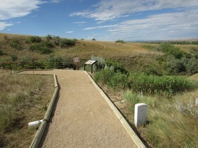
Location. 45° 33.913′ N, 107° 25.809′ W. Marker is in Crow Agency, Montana, in Big Horn County. Marker can be reached from Little Bighorn Battlefield Road, on the right when traveling south. Marker is at the end of the Deep Ravine Trail that starts near the Visitor Center. Touch for map. Marker is in this post office area: Crow Agency MT 59022, United States of America. Touch for directions.
Other nearby markers. At least 8 other markers are within walking distance of this marker. Bear Paw Monument (approx. 0.3 miles away); Cheyenne Warrior Markers (approx. 0.3 miles away); National Cemetery (approx. 0.3 miles away); Keogh – Crazy Horse Fight (approx. 0.3 miles away); Bear Paw Memorial (approx. 0.3 miles away); Here We Remember the Fallen (approx. 0.3 miles away); a different marker also named Deep Ravine (approx. 0.4 miles away); Last Stand Hill, June 25, 1876 (approx. 0.4 miles away). Touch for a list and map of all markers in Crow Agency.
More about this marker. The background of the marker features a scene of the batting in the Deep Ravine.
Also see . . . The Battle of the Little Bighorn, 1876. (Submitted on August 7, 2015, by Bill Coughlin of Woodland Park, New Jersey.)
Credits. This page was last revised on July 25, 2018. It was originally submitted on August 7, 2015, by Bill Coughlin of Woodland Park, New Jersey. This page has been viewed 1,443 times since then and 82 times this year. Photos: 1, 2, 3, 4, 5, 6, 7. submitted on August 7, 2015, by Bill Coughlin of Woodland Park, New Jersey.
