Lafayette in Tippecanoe County, Indiana — The American Midwest (Great Lakes)
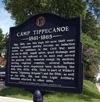
Camp Tippecanoe
1861 - 1865
Erected by Tippecanoe County Historical Association.
Topics. This historical marker is listed in these topic lists: Patriots & Patriotism • Peace • War, US Civil. A significant historical year for this entry is 1861.
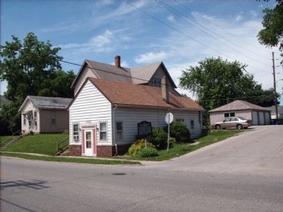
Location. Marker has been reported missing. It was located near 40° 24.255′ N, 86° 53.584′ W. Marker was in Lafayette, Indiana, in Tippecanoe County. Marker was at the intersection of Fourth Street (State Road 25) and Hickory Street, on the right when traveling south on Fourth Street. Touch for map. Marker was in this post office area: Lafayette IN 47901, United States of America. Touch for directions.
Other nearby markers. At least 8 other markers are within walking distance of this location. Highland Park (about 700 feet away, measured in a direct line); a different marker also named Highland Park (approx. 0.3 miles away); Highland Park Neighborhood (approx. half a mile away); The Ellsworth Historic District (approx. 0.7 miles away); Ninth Street Hill (approx. 0.7 miles away); The Red Crown Mini-Museum (approx. 0.9 miles away); Earl & Hatcher Block (approx. 0.9 miles away); John Purdue Block (approx. 0.9 miles away). Touch for a list and map of all markers in Lafayette.
Additional keywords. Induction Center, Regiments organized
Credits. This page was last revised on June 21, 2021. It was originally submitted on July 1, 2008, by Al Wolf of Veedersburg, Indiana. This page has been viewed 2,951 times since then and 41 times this year. Photos: 1, 2. submitted on July 1, 2008, by Al Wolf of Veedersburg, Indiana. • Craig Swain was the editor who published this page.

