Sullivans Island in Charleston County, South Carolina — The American South (South Atlantic)
Defending Charleston
1776-1947
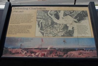
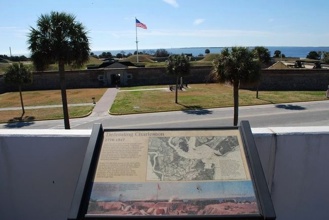
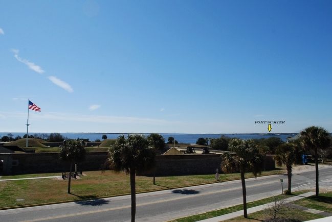
From this observation deck the strategic value of Fort Moultrie becomes clear. Charleston Harbor's main ship channel—the only deep water access to the port—passes directly in front of the fort. Ships entering the harbor had to pass close under the fire of Fort Moultrie's guns. From the time of the American Revolution through World War II, the fort's position on the south end of Sullivan's Island was the key to defending Charleston.
Today Fort Moultrie preserves the story of evolution of American coastal defense. Almost all of America's wars between the Revolution and World War II—and peacetimes in between—have left their mark here. Many remnants of those times can be seen in the fort today. A walk through Fort Moultrie is a walk through time.
(captions)
(bottom) A Civil War view from Fort Moultrie, November 18, 1863, Confederates held the fort. Union blockade ships and ironclad gunboats kept their distance. Fort Sumter, in the harbor to the right, was partially crumbled from Union bombardment. Compare this wartime scene painted by Conrad Wise Chapman to your view today.
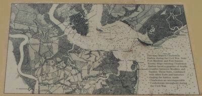
(upper right) This map depicts Charleston Harbor during the Civil War. Note Fort Moultrie and Fort Sumter. Enemy ships entering Charleston Harbor faced a gauntlet of deadly crossfire between Moultire and Sumter. These forts, combined with other forts and batteries ringing the harbor, made Charleston an unconquerable Confederate stronghold during the Civil War.
Topics. This historical marker is listed in these topic lists: Forts and Castles • War, US Civil. A significant historical date for this entry is November 18, 1866.
Location. 32° 45.616′ N, 79° 51.457′ W. Marker is on Sullivans Island, South Carolina, in Charleston County. Marker can be reached from the intersection of Middle Street and Osceola Avenue, on the right when traveling west. Marker is located atop Fort Moultrie Visitors Center. Take the stairs to the Observation Deck on the roof of the visitors center. Touch for map. Marker is at or near this postal address: 1214 Middle Street, Sullivans Island SC 29482, United States of America. Touch for directions.
Other nearby markers. At least 8 other markers are within walking distance of this marker. Station Hospital (a few steps from this marker); Fort Moultrie Torpedo Storehouse (within shouting distance of this marker); Grave of General William Moultrie (within shouting distance of this marker); a different marker also named Fort Moultrie Torpedo Storehouse (within shouting distance of this marker); Historic Fort Sumter - Fort Sumter Today (within shouting distance of this marker); Oceola / Patapsco Dead (within shouting distance of this marker); Northwest Bastionet (within shouting distance of this marker); From Military Base to National Park (about 300 feet away, measured in a direct line). Touch for a list and map of all markers in Sullivans Island.
Also see . . . Fort Moultrie. Fort Sumter National Monument (Submitted on August 11, 2015.)
Credits. This page was last revised on May 22, 2020. It was originally submitted on August 11, 2015, by Brandon Fletcher of Chattanooga, Tennessee. This page has been viewed 357 times since then and 23 times this year. Photos: 1, 2, 3, 4, 5. submitted on August 11, 2015, by Brandon Fletcher of Chattanooga, Tennessee. • Bernard Fisher was the editor who published this page.


