Fort Laramie in Goshen County, Wyoming — The American West (Mountains)
The “Government Workhouse”
Fort Laramie National Historic Site
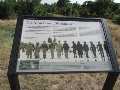
“I am beginning to think the soldiers … know better how to handle pick and shovel than they do a gun …”Private George W. McAnulty,
Fort Laramie, W.T., 1878
“ … nothing worries a soldier more than doing the dirty [work] about the post.”Private Paul Lindsley Mulford,
7th U.S. Cavalry
The daily routine of the frontier army enlisted man was a highly regimented, never-ending cycle of drills, guard duty, roll calls, inspections, and fatigue details. Isolation, boredom, and monotony most often defined his existence.
Fatigue details were a major source of discontent among the troops. Complaining that they were used more frequently as cheap labor than as soldiers, they derisively referred to military posts as “government workhouses.”
Typical fatigue details included constructing and maintaining roads, telegraph lines, and buildings, lime-making, cutting and milling wood, garbage and night soil disposal, water-hauling, and putting-up hay. Especially unpopular was cutting and storing ice. Ice cutting work was heavy, hard, and invariably performed during the coldest part of the winter. The soldiers’ clothing often got wet and froze in contact with the chill air, making it nearly unbearable to wear.
Ice Houses
Constructed partially underground with thick, solid walls and no ventilation, these structures held up to 150 tons of ice. If carefully rationed by the commanding officer, this ice supply could last until September.
Erected by National Park Service, U.S. Department of the Interior.
Topics. This historical marker is listed in this topic list: Forts and Castles. A significant historical year for this entry is 1878.
Location. 42° 12.07′ N, 104° 33.561′ W. Marker is in Fort Laramie, Wyoming, in Goshen County. Marker is on State Highway 160, on the left when traveling west. Marker is located at Fort Laramie National Historic Site. Touch for map. Marker is in this post office area: Fort Laramie WY 82212, United States of America. Touch for directions.
Other nearby markers. At least 8 other markers are within walking distance of this marker. Fort William and the Fur Trade (within shouting distance of this marker); Fort John – The ‘Second Fort Laramie’ (within shouting distance of this marker); Between Two Worlds . . . the American Métis (within shouting distance of this marker); Captain’s Quarters (about 300 feet away, measured in a direct line); Refinement at Fort Laramie (about 300 feet away); Reading, ‘Riting, and ‘Rithmetic (about 400 feet away); Officers Quarters (about 400 feet away); Administration Building (about 400 feet away). Touch for a list and map of all markers in Fort Laramie.
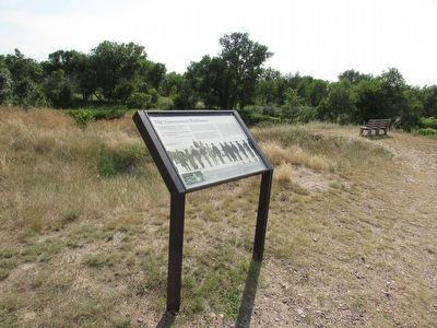
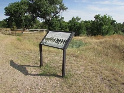
More about this marker. The bottom of the marker contains a photograph of an “Ice cutting fatigue detail, Fort Keogh, about 1880.” A smaller photograph shows “Detail of Fort Laramie showing the ice house.”
Also see . . . Fort Laramie National Historic Site. (Submitted on August 11, 2015, by Bill Coughlin of Woodland Park, New Jersey.)
Credits. This page was last revised on October 27, 2021. It was originally submitted on August 11, 2015, by Bill Coughlin of Woodland Park, New Jersey. This page has been viewed 268 times since then and 9 times this year. Photos: 1, 2, 3. submitted on August 11, 2015, by Bill Coughlin of Woodland Park, New Jersey.


