Cedarburg in Ozaukee County, Wisconsin — The American Midwest (Great Lakes)
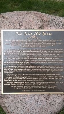
The First 100 Years
In 1901, city fathers directed that a steam-powered electric light plant be built on this site. By 1903, it was generating nightly power for 78 customers. Daytime generation was added when local women requested power on Mondays for their new electric washing machines and on Tuesdays for electric irons. The Industrial Revolution was on a roll, and by 1910, the power plant was running 24 hours a day, seven days a week.
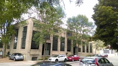
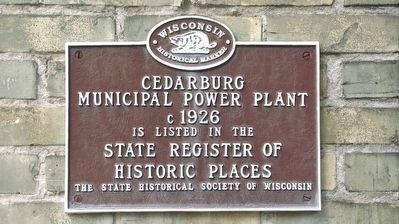
Following World War I, citizens pressed for continued modernization. They voted for a public water and sewer system and on January 21, 1923, the fire whistle blared to signal the completion of the project. In 1925, the power plant was expanded and diesel engines were installed. Further expansions occurred in the decades that followed, and by the 1960s, a portion of Cedarburg's power was purchased from outside souruces in response to soaring diesel fuel costs. In 1980, wanting to maintain its energy independence and secure long-term access to low-cost power, Cedarburg joined 22 other community-owned utilities to form Wisconsin Public Power Inc. Several years later, the power plant ceased operation and in 1996, the building, which stands directly to the north, was sold to The Kubala Washatko Architects. Through careful renovation, many of the original characteristics were preserved.
Today, Cedarburg is among 2,000 communities nationwide that own and operate their own utilities.
On August 11, 2001, Cedarburg Light & Water joined the community in a celebration of the first 100 years of local utility ownership at a "Lawn Party by Electric Light" in Cedar Creek Park. Guests signed a registry, which has been sealed in a time capsule and buried on this site. As a lasting commemoration of the first 100 years of municipal utility ownership, this rest area was donated by Cedarburg Light & Water to the citizens of Cedarburg for all to enjoy.
This area is dedicated to Carl Klug and Wilmer Boerner, who died while working on the engines at the Cedarburg power plant in 1937 and 1942, respectively.
Erected 2002.
Topics and series. This historical marker is listed in this topic list: Industry & Commerce. In addition, it is included in the Time Capsules series list. A significant historical month for this entry is January 1979.
Location. 43° 17.852′ N, 87° 59.166′ W. Marker is in Cedarburg, Wisconsin, in Ozaukee County. Marker is on North Mequon Avenue, on the left when traveling north. Touch for map. Marker is in this post office area: Cedarburg WI 53012, United States of America. Touch for directions.
Other nearby markers. At least 8 other markers are within walking distance of this marker. Origin of Cedar Creek / Mills on the Creek (a few steps from this marker); Cedarburg Mill (within shouting distance of this marker); Interurban Bridge / Riding the Interurban (about 600 feet away, measured in a direct line); The History of the Boerner Building (about 600 feet away); Liberty Tree Memorial (about 600 feet away); Cedarburg Cultural Center Building (about 800 feet away); Historic Cedarburg (approx. 0.2 miles away); Washington Avenue Historic District / Historic District Architecture (approx. 0.2 miles away). Touch for a list and map of all markers in Cedarburg.
Credits. This page was last revised on June 16, 2016. It was originally submitted on August 12, 2015, by Devon Polzar of Port Washington, Wisconsin. This page has been viewed 405 times since then and 19 times this year. Photos: 1, 2, 3, 4. submitted on August 12, 2015, by Devon Polzar of Port Washington, Wisconsin. • Andrew Ruppenstein was the editor who published this page.


