Buckhead in Atlanta in Fulton County, Georgia — The American South (South Atlantic)
The Federal Advance
The Battle of Peachtree Creek
— Tablet #3 —
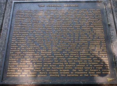
After noon on July 9th, Schofield´s Army of the Ohio (23rd Corps) had forced Johnston to cross the Chattahoochee River that night by a surprise crossing up river at Soap Creek. On the 12th, Howard´s 4th Corps of Thomas´ Army of the Cumberland (4th, 14th and 20th Corps) crossed Power´s Ferry on Schofield´s right. As Johnston had foreseen, McPherson´s Army of the Tennessee (15th, 16th and 17th Corps) moved upriver to Roswell and began crossing while Palmer´s 14th Corps and Hooker´s 20th Corps prepared to cross at Pace´s Ferry. On the 17th, Palmer crossed and moved toward Peachtree Creek and McPherson moved toward Decatur. On the 18th, Schofield, accompanied by Sherman, moved toward Decatur to connect with McPherson; Howard moved to Buckhead; Palmer reached Peachtree Creek; and Hooker crossed the river and camped along West Pace´s Ferry Road. By nightfall, Sherman´s unsupported right wing occupied a line facing Peachtree Creek extending from Buckhead to the river. So far, the advance had been harassed by Wheeler´s cavalry alone. It had met no enemy infantry. On the 18th, Wood´s division of Howard´s corps moved down Peachtree Road to the creek and captured the bridge. Hooker advanced to the creek, placed his artillery on the hills, and crossed the infantry of Geary´s division on an improvised footbridge at Northside Drive. Geary drove back the enemy´s skirmishers, occupied the hills by the creek and built two wagon bridges for the artillery and trains. Ward´s division was sent to Peachtree Road to cross next day and move up on Geary´s left. On the 20th, Geary moved to Collier Road and took position with Candy´s brigade on the left, near Tanyard Branch, Jones´ on his right extending to Northside Drive, and Ireland´s massed behind Jones´. Candy´s left overlooked this site. Bundy´s and Sloan´s batteries were placed on Candy´s line to sweep the open ground to the left front. The 33rd N.J. Infantry was advanced to picket the ridge between Greystone and Colland Drives. William´s division crossed the creek and formed on the ridge along Northfleet Road with a deep ravine covering his front, Knip´s brigade, on the rightextended to Howell Mill Road, with Ruger´s behind it in reserve and Roberson´s extending east across Northside Drive, behind Geary´s right. On Howell Mill Road, Anson G. McCook´s brigade, the left of Palmer´s corps, entrenched near Ruger. Ward´s division crossed at Peachtree Road and moved southeast over broken ground, leaving two batteries at the bridge.
Erected 1964 by Georgia Historic Commission - Georgia Civil War Centennial Commission.
Topics. This historical marker is listed in this topic list: War, US Civil.
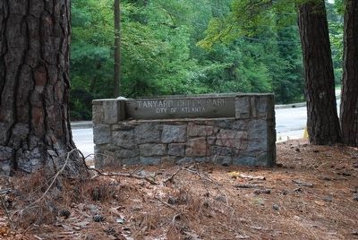
Location. 33° 48.628′ N, 84° 24.185′ W. Marker is in Atlanta, Georgia, in Fulton County. It is in Buckhead. Marker can be reached from the intersection of Collier Rd NW and Walthall Drive NW, on the left when traveling west. Located along Beltline Trail in Tanyard Creek Park. Touch for map. Marker is in this post office area: Atlanta GA 30318, United States of America. Touch for directions.
Other nearby markers. At least 8 other markers are within walking distance of this marker. The Federal Forces Engaged/The Confederate Forces Engaged (here, next to this marker); The Federal Advance, Cont./The Change of Command (here, next to this marker); The Confederate Attack (here, next to this marker); The Confederate Attack, Cont. (here, next to this marker); The Battle of Peachtree Creek (here, next to this marker); Battle of Peach Tree Creek (here, next to this marker); On Geary's Front (within shouting distance of this marker); Scott's Brigade (within shouting distance of this marker). Touch for a list and map of all markers in Atlanta.
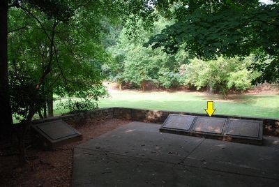
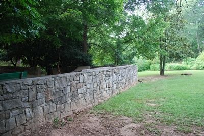
More about this marker. 1 of 6 markers related to the Battle of Peachtree Creek located here. All markers are mounted on concrete pillars and are located in a semi-circular fashioned line, surrounded by a stone wall.
Credits. This page was last revised on February 8, 2023. It was originally submitted on August 15, 2015, by Brandon Fletcher of Chattanooga, Tennessee. This page has been viewed 488 times since then and 14 times this year. Photos: 1, 2, 3, 4, 5. submitted on August 15, 2015, by Brandon Fletcher of Chattanooga, Tennessee. • Bernard Fisher was the editor who published this page.


