Where Wagons Rolled / Wieduwilt Swales
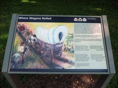
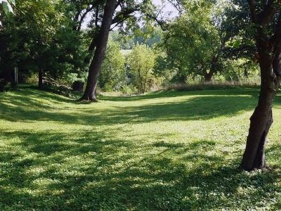
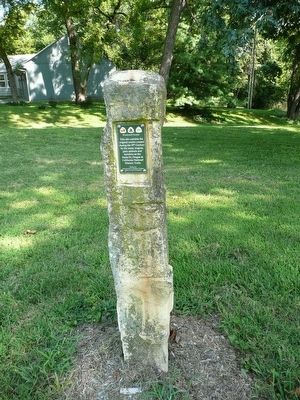
Thousands of wagon wheels, animal hooves, and human feet once passed this way – creating the deep depression in front of you. The swale, now worn by erosion, is grassed-over evidence of three trails once connecting frontier Missouri to distant lands. In the mid-1800s, caravans moving through here hauled freight between Missouri and Santa Fe. Overland emigrants followed, headed for Oregon’s farmlands or California’s gold fields.
This swale, evidence of past trail use, is one of the few known in the greater Kansas City area.
During some years, wet and muddy conditions on the trails led to frustrating delays, yet memorable experiences.
“Amid the fiercest storm I have yet witnessed on the trip, I encamped last night with a party of ‘our folks’ and though I was literally soaked through when I arose in the morning from my grassy couch, I never slept more profoundly, nor experience healthier feeling. Favored with pleasanter weather, we continued, after breakfast, our ride to the plains.”
George L. Curry, May 1846, writing near this site.
“The first day we got but 3 miles from town with half our wagons the other half we left mired in devious & sundry mudholes stung along for a mile behind. On Sunday morning we started and got on pretty well until dare overtook us at Mr. Barne’s
place 8 miles from town where we encamped and place our animals all in his pasture. It commenced pouring down rain soon after dark and the next morning the roads were so slippery & muddy that we could not stir about 12 oclk …”William H. Glasgow, June 1846, writing near the site.
Kesse Barnes mentioned by William H. Glasgow, owned a large amount of land, part of which is preserved today for public enjoyment and education at Cave Spring 1.8 miles northeast of this location.
Erected by National Park Service - Cave Spring Association.
Topics and series. This historical marker is listed in these topic lists: Roads & Vehicles • Settlements & Settlers. In addition, it is included in the Oregon Trail, and the Santa Fe Trail series lists. A significant historical year for this entry is 1846.
Location. 38° 58.215′ N, 94° 29.915′ W. Marker is in Kansas City, Missouri, in Jackson County. It is in Park Farms. Marker is on 85th St, on the left when traveling east. Touch for map. Marker is in this post office area: Kansas City MO 64138, United States of America. Touch for directions.
Other nearby markers. At least 8 other markers are within 4 miles of this marker, measured as the crow flies. The Barnes Enclosure (approx. 1.9 miles away); Richards Flying Field (approx. 2.1 miles away); 1844 Homestead (approx. 2½ miles away); The Battle of White Oak Creek (approx. 3.1 miles away); Russell's Ford (approx. 3.1 miles away); William Ray Blacksmith Shop (approx. 3.3 miles away); Flanery-Frost Cemetery (approx. 3.3 miles away); Kansas City's First Public Golf Course (approx. 3.4 miles away). Touch for a list and map of all markers in Kansas City.
Also see . . .
1. Santa Fe National Historic Trail. (Submitted on September 7, 2015, by William Fischer, Jr. of Scranton, Pennsylvania.)
2. Oregon National Historic Trail. (Submitted on September 7, 2015, by William Fischer, Jr. of Scranton, Pennsylvania.)
Credits. This page was last revised on February 10, 2023. It was originally submitted on August 17, 2015, by Michael W. Kruse of Kansas City, Missouri. This page has been viewed 802 times since then and 54 times this year. Photos: 1, 2, 3. submitted on August 17, 2015, by Michael W. Kruse of Kansas City, Missouri. • Bill Pfingsten was the editor who published this page.


