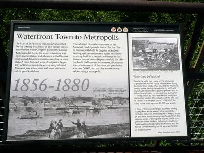
River Market in Kansas City in Jackson County, Missouri — The American Midwest (Upper Plains)
Waterfront Town to Metropolis
1856-1880
By May of 1854 the air was already electrified by the sizzling-hot debate of pro-slavery versus anti-slavery when Congress passed the Kansas-Nebraska Act. Now, the western territory was open and available, and whoever settled Kansas first would determine its status as a free or slave state. A new frenzied wave of migration began. City of Kansas residents were acutely affected. Missouri was a slave state and most residents held a pro-South bias.
The addition of another free state on the Missouri border posed a threat. But the City of Kansas, with both its popular steamboat landing and its unsurpassed access to the new territory, held an economic advantage as this historic turn of events began to unfold. By 1880 the bluffs had been cut into the streets, the city ran several miles south of the river, the population was over 50,000, and the city was on its way to becoming a metropolis.
[Picture caption]
An idyllic scene of the City of Kansas from the opposite side of the river. Illustrations and Photographs courtesy of Missouri Valley Special Collections, Kansas City Public Library, Kansas City, Missouri.
[Side panel]
Which Scene Do You See?
Despite the idyllic river scene on the left, hordes of people were rushed up the Missouri River during the contentious 1850s. They crowded the steamboat landing before passing through the city bluffs and scurrying to establish their physical presence and to influence which party – pro-slavery or abolitionist – would prevail. By 1855 the flood of immigrants dramatically swelled the population of the little City of Kansas. In a two-year period, 1855-1857, the Gilliss house Hotel reported 27,000 new arrivals.
“In front of the town the broad bouldered landing slopping down to the water’s edge presented a confusing picture of immense piles of freight, horse, ox, and mule teams receiving merchandise from the steamer, scores of immigrants wagons, and a busy crowd of whites, Indians, half-breeds… Carts and horses wallowed in the deep excavations; and the houses stood trembling on the verge as if in fear of tumbling down.
Albert Richardson, spring 1857
Erected by National Park Service and Kansas City Area Historic Trails Association.
Topics. This historical marker is listed in these topic lists: Abolition & Underground RR • Industry & Commerce • Settlements & Settlers • Waterways & Vessels. A significant historical month for this entry is May 1854.
Location. 39° 6.747′ N, 94° 35.057′ W. Marker is in Kansas City, Missouri, in Jackson County. It is in River Market. Marker can be reached from Main Street. About two thirds of the way down the Riverfront Heritage Trail to the Town of Kansas Observation deck, in cove on the west(left)side. Touch for map. Marker is in this post office area: Kansas City MO 64106, United States of America. Touch for directions.
Other nearby markers. At least 8 other markers are within walking distance of this marker. From Steamboat Landing to City (here, next to this marker); Hannibal Bridge (within shouting distance of this marker); Gilliss House Hotel (within shouting distance of this marker); Building Through the Bluffs (within shouting distance of this marker); City Market (approx. 0.2 miles away); W. H. Morgan & Company (approx. ¼ mile away); J. P. Campbell & Company Building (approx. ¼ mile away); General Orders No. 11 (approx. ¼ mile away). Touch for a list and map of all markers in Kansas City.
Credits. This page was last revised on February 10, 2023. It was originally submitted on August 20, 2015, by Michael W. Kruse of Kansas City, Missouri. This page has been viewed 372 times since then and 17 times this year. Photo 1. submitted on August 20, 2015, by Michael W. Kruse of Kansas City, Missouri. • Bill Pfingsten was the editor who published this page.
Editor’s want-list for this marker. A wide shot of the marker and its surroundings. • Can you help?
