Cody in Park County, Wyoming — The American West (Mountains)
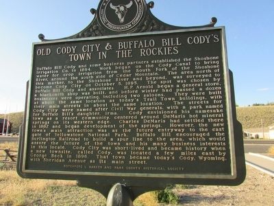
Old Cody City & Buffalo Bill Cody’s Town in the Rockies
Inscription.
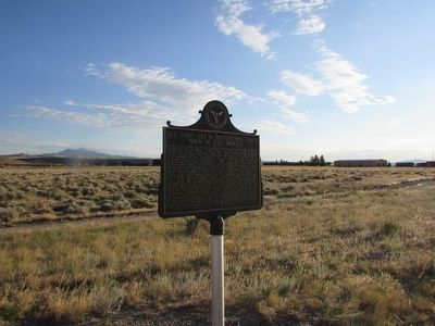
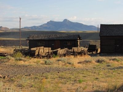
Buffalo Bill Cody and some business partners established the Shoshone Irrigation Co. in 1894. Work began on the Cody Canal to bring water for crop irrigation from the South Fork of the Shoshone River, around the south side of Cedar Mountain. The area north of this marker, to the Shoshone River and beyond, was surveyed to become Cody City on October 5, 1895. The spot was chosen by Buffalo Bill Cody and associates. H.P. Arnold began a general store, a blacksmith shop was built, and before winter had passed a dozen businesses were operating, including two saloons. They were built at about the same location as today’s Trail Town buildings, with their main streets in about the same location. The streets for Cody City were named after Civil War generals, with a park named for Buffalo Bill’s daughter, Irma. Cody envisioned his namesake town as a resort community, centered around DeMaris hot mineral springs on its western edge. Charles DeMaris had settled there in 1882 and began development of the springs. However, the new town’s main attraction was the future entryway to the east gate of Yellowstone National Park. Buffalo Bill encouraged the Burlington Railroad to build a spur line to the area, which would assure the future of the town and his many business interests in this locale. Cody City was short-lived and became history when a new townsite, called Cody, was located a few miles east by George Beck in 1896. That town became today’s Cody, Wyoming, with Sheridan Avenue as its main street.
Erected by Rotchford L. Barker and Park County Historical Society.
Topics. This historical marker is listed in this topic list: Settlements & Settlers. A significant historical month for this entry is October 1883.
Location. 44° 30.828′ N, 109° 6.305′ W. Marker is in Cody, Wyoming, in Park County. Marker is on W Yellowstone Avenue (U.S. 20) 0.1 miles west of Demaris Drive, on the right when traveling west. Touch for map. Marker is in this post office area: Cody WY 82414, United States of America. Touch for directions.
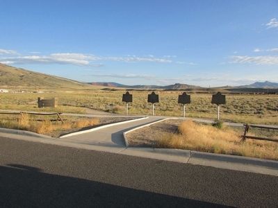
Other nearby markers. At least 8 other markers are within walking distance of this marker. Indian Names for Land Features (here, next to this marker); Colter’s Hell & Extinct Geyser Basin (here, next to this marker); The Panoramic View (a few steps from this marker); Cedar Mountain (about 300 feet away, measured in a direct line); Trail to Old Cody City (about 400 feet away); Belle Drewry (about 500 feet away); Lee Street – Cody City (about 500 feet away); W.A. Gallagher and Blind Bill (about 500 feet away). Touch for a list and map of all markers in Cody.
Credits. This page was last revised on June 16, 2016. It was originally submitted on August 22, 2015, by Bill Coughlin of Woodland Park, New Jersey. This page has been viewed 559 times since then and 16 times this year. Photos: 1, 2, 3, 4. submitted on August 22, 2015, by Bill Coughlin of Woodland Park, New Jersey.


