Near Fort Oglethorpe in Catoosa County, Georgia — The American South (South Atlantic)
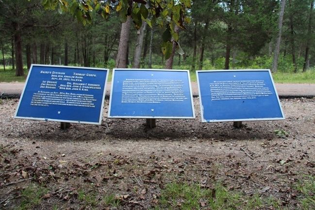
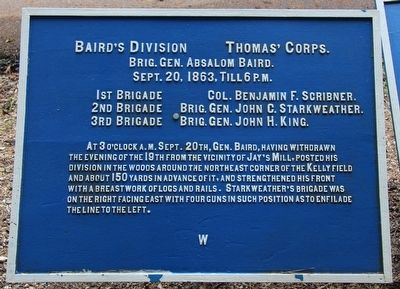
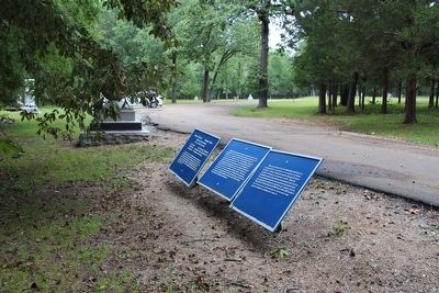
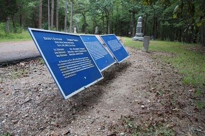
Baird's Division
Thomas' Corps.
— Brigadier General Absalom Baird —
Brigadier General Absalom Baird.
September 20, 1863, till 6 p.m.
1st Brigade - Colonel Benjamin F. Scribner.
2nd Brigade - Brigadier General John C. Starkweather.
3rd Brigade - Brigadier General John H. King.
At 3 o'clock a.m. September 20th, General Baird, having withdrawn the evening of the 19th from the vicinity of Jay's Mill, posted his division in the woods around the northeast corner of the Kelly field and about 150 yards in advance of it, and strengthened his front with a breastwork of logs and rails. Starkweather's brigade was on the right facing east with four guns in such position as to enfilade the line to the left.
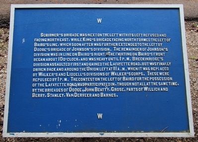
Text on the Second Tablet:
Scribner's brigade was next on the left with its left refused and facing north east, while King's brigade facing north formed the left of the Baird's line, which soon after was further extended to the left by Dodge's brigade of Johnson's division. The remainder of Johnson's division was in line on Baird's right. The fighting on Baird's front began about 10 o'clock, and was heavy until 1 p.m. Breckinridge's division assaulted first and gained the Lafayette road, but was finally driven back and around the Union left at 11 a.m. when it was replaced by Walker's and Liddell's divisions of Walker's corps. These were repulsed by 1 p.m. The contest on the left of Baird for the possession of the Lafayette road was participated in, though not all at the same time, by the brigades of Dodge, John Beatty, Grose, parts of Willich and Berry, Stanley, VanDerveer and Barnes.
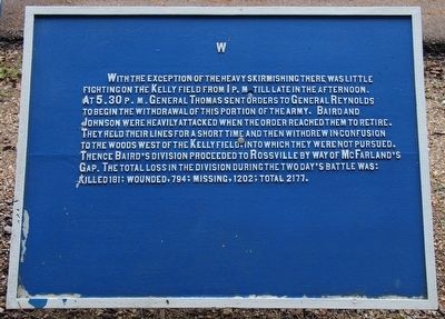
Text on the Third Tablet:
With the exception of the heavy skirmishing there was little fighting on the Kelly field from 1 p.m. till late in the afternoon. At 5:30 p.m. General Thomas sent orders to General Reynolds to begin the withdrawal of this portion of the army. Baird and Johnson were heavily attacked when the order reached them to retire. They held their lines for a short time and then withdrew in confusion to the woods west of the Kelly field, into which they were not pursued. Thence Baird's division proceeded to Rossville by way of McFarland's Gap. The total loss in the division during the two day's battle was: killed 181; wounded, 794; missing, 1202; total 2177.
Erected 1890 by the Chickamauga and Chattanooga National Military Park Commission. (Marker Number MT-491-93.)
Topics. This historical marker is listed in this topic list: War, US Civil. A significant historical date for this entry is September 20, 1863.
Location. 34° 55.975′ N, 85° 15.328′ W. Marker is near Fort Oglethorpe, Georgia, in Catoosa County. Marker is on Battleline Road south of Alexander Bridge Road, on the right when traveling south. This tablet is located in the national park that preserves the site of the Chickamauga Battlefield, The tablet is located at the extreme northern end of the line of mostly Union monuments, markers, and tablets that are situated along the park's Battleline Road. Touch for map. Marker is in this post office area: Fort Oglethorpe GA 30742, United States of America. Touch for directions.
Other nearby markers. At least 8 other markers are within walking distance of this marker. 2nd Ohio Infantry (here, next to this marker); 3rd and 5th Confederate Tennessee Infantry (here, next to this marker); 33rd Ohio Infantry (within shouting distance of this marker); 10th Wisconsin Infantry (within shouting distance of this marker); Maney's Brigade (within shouting distance of this marker); Scribner's Brigade (within shouting distance of this marker); 18th United States Infantry (within shouting distance of this marker); 2nd Tennessee Infantry (within shouting distance of this marker). Touch for a list and map of all markers in Fort Oglethorpe.
More about this marker.
I used the "Chickamauga Battlefield" map, that I purchased at the Chickamauga and Chattanooga National Military Park, Visitor Center, to determine both the marker number for this tablet and the tablet's location in relation to the rest of the park's monuments, markers, and tablets. According to the map it provides the, "numerical listing of all monuments, markers, and tablets on the Chickamauga Battlefield (using the Chick-Chatt NMP Monument Numbering System).”
Related markers. Click here for a list of markers that are related to this marker. Use this link to see the Brigade tablets for this Division.
Credits. This page was last revised on July 3, 2017. It was originally submitted on August 24, 2015, by Dale K. Benington of Toledo, Ohio. This page has been viewed 363 times since then and 23 times this year. Photos: 1, 2, 3, 4, 5, 6. submitted on August 24, 2015, by Dale K. Benington of Toledo, Ohio.
