Marker Logo HMdb.org THE HISTORICAL
MARKER DATABASE
“Bite-Size Bits of Local, National, and Global History”
Meade in Macomb County, Michigan — The American Midwest (Great Lakes)
 

Crawford Settlement Burying Ground


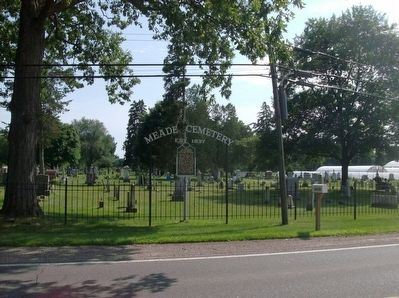
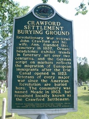
Crawford Settlement Burying Ground Marker image. Click for full size.
Photographed By Joel S., August 23, 2015
1. Crawford Settlement Burying Ground Marker
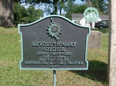
Inscription. Revolutionary War veteran John Crawford and his wife, Ann, founded this cemetery in 1837. Ornate headstones exhibit trends in funerary art over two centuries, and the German script on markers reflects the migration of European immigrants after the Erie Canal opened in 1825. Veterans of every major war since the American Revolution are buried here. The community was named Meade in 1863, but remained locally known as the Crawford Settlement.
 
Erected 2006 by Michigan Historical Commission - Michigan Historical Center. (Marker Number S2170.)
 
Topics. This historical marker is listed in this topic list: Cemeteries & Burial Sites. A significant historical year for this entry is 1837.
 
Location. 42° 43.077′ N, 82° 51.954′ W. Marker is in Meade, Michigan, in Macomb County. Marker is on 26 Mile Road, 0.6 miles east of North Avenue, on the right when traveling east. Meade is an unincorporated community in Macomb Township and there is no sign indicating that you are entering Meade. The cemetery is near Austin Catholic Academy High School on the opposite side of the street. Touch for map. Marker is at or near this postal address: 24350 26 Mile Road, Macomb MI 48042, United States of America. Touch for directions.
 
Other nearby markers. At least 8 other markers are within 5 miles of this marker, measured as the crow flies. Walter C. Wetzel State Recreation Area (approx.
Paid Advertisement
Click on the ad for more information.
Please report objectionable advertising to the Editor.
Click or scan to see
this page online
2.3 miles away); "The Dorr" (approx. 4˝ miles away); Millstones (approx. 4.6 miles away); Wolcott Mill (approx. 4.6 miles away); Religious Society Church (approx. 4.8 miles away); Ray Township District No. 1 School (approx. 4.8 miles away); St. Peter Lutheran Church (approx. 4.9 miles away); First Methodist Episcopal Church (approx. 4.9 miles away).
 
Crawford Settlement Burying Ground Marker image. Click for full size.
Photographed By Joel S., August 23, 2015
2. Crawford Settlement Burying Ground Marker
John Crawford Burial Marker image. Click for full size.
Photographed By Joel S., August 23, 2015
3. John Crawford Burial Marker
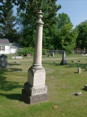
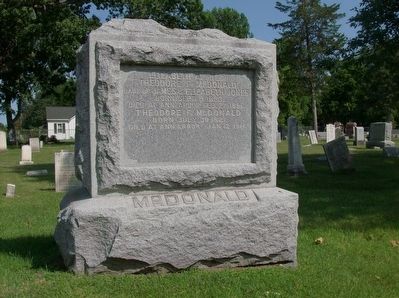
Example gravestone image. Click for full size.
Photographed By Joel S., August 23, 2015
4. Example gravestone
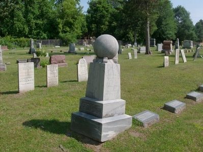
Example gravestone image. Click for full size.
Photographed By Joel S., August 23, 2015
5. Example gravestone
Example gravestone image. Click for full size.
Photographed By Joel S., August 23, 2015
6. Example gravestone
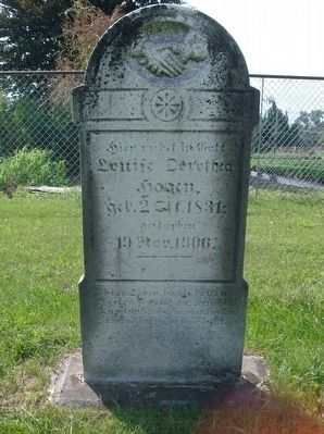
Example gravestone with German writing image. Click for full size.
Photographed By Joel S., August 23, 2015
7. Example gravestone with German writing
 
 
Credits. This page was last revised on June 16, 2016. It was originally submitted on August 25, 2015, by Joel Seewald of Madison Heights, Michigan. This page has been viewed 956 times since then and 67 times this year. Photos:   1, 2, 3, 4, 5, 6, 7. submitted on August 25, 2015, by Joel Seewald of Madison Heights, Michigan.
Share this page.  
Share on Tumblr
m=87681

CeraNet Cloud Computing sponsors the Historical Marker Database.
This website earns income from purchases you make after using our links to Amazon.com. We appreciate your support.
Paid Advertisement
Apr. 16, 2024