Lewellen in Garden County, Nebraska — The American Midwest (Upper Plains)
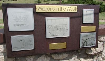
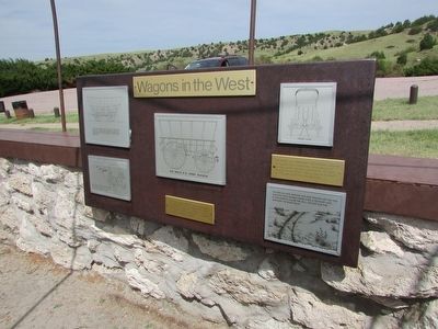
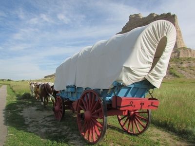
Wagons in the West
Under a picture of a large covered wagon:
The Conestoga was a heavy freight wagon. Very few passed over the Oregon Trail because of the rough terrain.
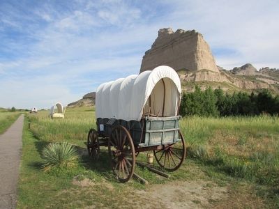
Under a picture of a travelers in a Prairie Schooner:
Thousands of emigrants passed over this trail from 1841-1859 in wagons similar to this.
Under a picture of a Six Mule U.S. Army Wagon:
The army, too, relied on wagon transport. Hundreds of six mule wagons like these moved the supplies for combat units in the field. Commercial freighters supplied the forts and base camps.
Under a picture of the front view of a Freighter Wagon:
Freighters used still larger and heavier wagons to haul the food, hardware, and machinery needed in the western settlements. Freight moved about fifteen miles a day at as much as 25˘ per pound to the Rockies.
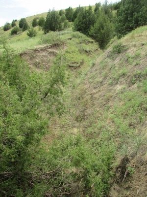
On the hillside before you are tracks left by the wagons that passed here over a century ago. If you wish to climb the hill, please use the walkway to your right.
Topics. This historical marker is listed in this topic list: Roads & Vehicles.
Location. 41° 15.784′ N, 102° 6.849′ W. Marker is in Lewellen, Nebraska, in Garden County. Marker can be reached from U.S. 26, on the right when traveling south. Marker is located in the Windlass Hill section of Ash Hollow State Historical Park. Touch for map. Marker is in this post office area: Lewellen NE 69147, United States of America. Touch for directions.
Other nearby markers. At least 8 other markers are within 2 miles of this marker, measured as the crow flies. Rough Going (here, next to this marker); Wagon Ruts (within shouting distance of this marker); Oregon Trail (about 700 feet away, measured in a direct line); Descent of Windlass Hill (approx. 0.2 miles away); a different marker also named The Oregon Trail (approx. 0.2 miles away); a different marker also named Oregon Trail (approx. 0.3 miles away); Windlass Hill Pioneer Homestead (approx. 1˝ miles away); School District 55 (approx. 1.6 miles away). Touch for a list and map of all markers in Lewellen.
Credits. This page was last revised on June 16, 2016. It was originally submitted on August 26, 2015, by Bill Coughlin of Woodland Park, New Jersey. This page has been viewed 396 times since then and 9 times this year. Photos: 1, 2. submitted on August 26, 2015, by Bill Coughlin of Woodland Park, New Jersey. 3, 4, 5. submitted on August 27, 2015, by Bill Coughlin of Woodland Park, New Jersey.
