Capitol Hill in Northeast Washington in Washington, District of Columbia — The American Northeast (Mid-Atlantic)
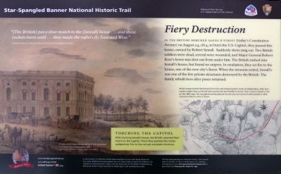
Fiery Destruction
Star-Spangled Banner National Historic Trail
— National Park Service, U.S. Department of the Interior —
“[The British] put a slow match to the [Sewall] house … and those rockets burst until … they made the rafters fly East and West.” — Enslaved African American diarist and eyewitness, Michael Shiner.
As the British marched along B Street (today's Constitution Avenue) on August 24, 1814, to burn the U.S. Capitol, they passed this house, owned by Robert Sewall. Suddenly shots rang out. Two British soldiers were dead, several were wounded, and Major General Ross's horse was shot out from under him. the British rushed into Sewall's house but found no snipers. In retaliation, they set fire to the house, one of the city's finest. When the invasion ended, Sewall's was one of the few private structures destroyed by the British. The family rebuilt here after peace returned.
Torching the Capitol
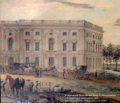
After burning Sewall's house, the British resumed their march to the Capitol. There they planted the Union Jack and set fire to the not-yet-complete structure.
In the summer of 1814 the United States had been at war with Great Britain for two years. Battlefronts had erupted from the Great Lakes to the Gulf of Mexico. On August 24, following their victory over the Americans at the Battle of Bladensburg, Maryland, British troops marched on Washington with devastating results.
The Star-Spangled Banner Historic Trail reveals sites of the War of 1812 in Washington, DC, Virginia and Maryland. Visit ChesapeakeExplorerApp.com or download the Chesapeake Explorer App.
Erected by National Park Service, U.S. Department of the Interior; Cultural Tourism DC.
Topics and series. This historical marker is listed in these topic lists: African Americans • Notable Events • War of 1812. In addition, it is included in the Star Spangled Banner National Historic Trail series list. A significant historical date for this entry is August 24, 1814.
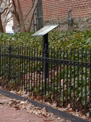
Location. 38° 53.534′ N, 77° 0.217′ W. Marker is in Northeast Washington in Washington, District of Columbia. It is in Capitol Hill. Marker is at the intersection of 2nd Street Northeast and Constitution Avenue Northeast (Alternate U.S. 1), on the right when traveling south on 2nd Street Northeast. Touch for map. Marker is at or near this postal address: 144 Constitution Avenue Northeast, Washington DC 20002, United States of America. Touch for directions.
Other nearby markers. At least 8 other markers are within walking distance of this marker. Alva Belmont House (a few steps from this marker); Residence of Albert Gallatin (a few steps from this marker); The Sewall-Belmont House & Museum (within shouting distance of this marker); Torch of Freedom (within shouting distance of this marker); From June to December, 1917 (within shouting distance of this marker); Cortelyou House (about 400 feet away, measured in a direct line); The Minuteman Memorial Building (about 600 feet away); a different marker also named The Minuteman Memorial Building (about 600 feet away). Touch for a list and map of all markers in Northeast Washington.
Photographed By Allen C. Browne, February 14, 2015
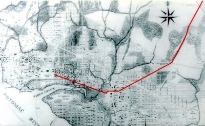
4. Invasion Route
British troops entered Washington from the east following their victory at Bladensburg. After burning the Capitol they continued west and burned the President's House. Their route is marked in red on this 1802 map. The map shows streets planned for the city, but not all of them existed in 1814.Close-up of map on marker
Credits. This page was last revised on January 30, 2023. It was originally submitted on February 15, 2015, by Allen C. Browne of Silver Spring, Maryland. This page has been viewed 671 times since then and 16 times this year. Last updated on August 29, 2015, by Allen C. Browne of Silver Spring, Maryland. Photos: 1, 2, 3, 4, 5. submitted on February 15, 2015, by Allen C. Browne of Silver Spring, Maryland. • Bill Pfingsten was the editor who published this page.
