De Kalb in St. Lawrence County, New York — The American Northeast (Mid-Atlantic)
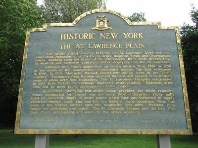
The St. Lawrence Plain
Historic New York
Although the French maintained an Indian mission from 1746 to 1756 at the mouth of the Oswegatchie, Ogdensburg became the first settlement in 1796. In 1791, Alexander Macomb bought four million acres in the "North Country". Purchasers from Macomb surveyed the land and opened it to settlers, many of whom were New Englanders. The St. Lawrence Turnpike constructed in 1810 from Malone to Carthage improved transpotation. Railroads after 1850 led to more rapid development of the region.
Agriculture, dairying, and maple sugar provided the basic economy. Potash production for export was an early local enterprise. Paper mills used the abundant supply of water power which later was harnessed to supply electrical energy. Lead, zinc and talc are found in large quantities. Near Star Lake is the world's largest open-cut magnetite iron mine. Massena is a center for aluminum production. The St. Lawrence Seaway and the New York State Power development add much to the area's economy.
Erected 1963 by New York State Education Department, New York State Department of Public Works.
Topics and series. This historical marker is listed in these topic lists: Agriculture • Environment • Industry & Commerce • Roads & Vehicles. In addition, it is included in the Historic New York State series list. A significant historical year for this entry is 1746.
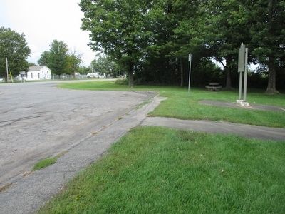
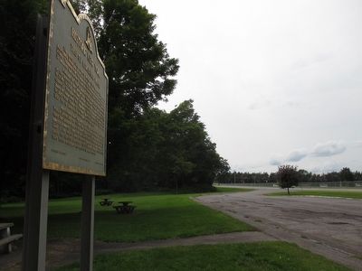
Location. 44° 28.902′ N, 75° 18.104′ W. Marker is in De Kalb, New York, in St. Lawrence County. Marker is on U.S. 11, 0.2 miles west of East De Kalb Road, on the right when traveling north. Marker is in a rest area across from Hermon-DeKalb Central School. Touch for map. Marker is in this post office area: De Kalb Junction NY 13630, United States of America. Touch for directions.
Other nearby markers. At least 8 other markers are within 7 miles of this marker, measured as the crow flies. DeKalb Junction (approx. 2.2 miles away); War of 1812 (approx. 2.4 miles away); DeKalb Village (approx. 2˝ miles away); Cooper’s Rock (approx. 2.6 miles away); Harlow Godard (approx. 6.4 miles away); Helen Rich (approx. 6.6 miles away); Richville Village (approx. 6.7 miles away); Richville Welsh Congregational Church (approx. 7 miles away). Touch for a list and map of all markers in De Kalb.
Credits. This page was last revised on June 16, 2016. It was originally submitted on August 30, 2015, by Anton Schwarzmueller of Wilson, New York. This page has been viewed 469 times since then and 25 times this year. Photos: 1, 2, 3. submitted on August 30, 2015, by Anton Schwarzmueller of Wilson, New York.


