Mattapoisett in Plymouth County, Massachusetts — The American Northeast (New England)
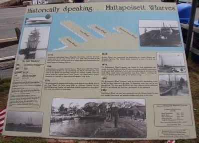
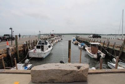
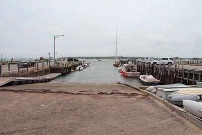
Mattapoisett Wharves
Historically Speaking ...
1752
Professional shipbuilding began. Originally, the builders used the abundant timber found in the area woods. Boats were built and launched on the Mattapoisett River. However, most of the larger ships were constructed at the harbor where development followed.
1766
Gideon Barstow established the first barstow Wharf, later called Short Wharf, for shipbuilding. In time, he was joined by his son Wilson, who had spent some years at sea. Wilson and his family enlarged the business. Rubble stone was used to build the original wharf. Later, granite was added from a quarry located on the west side of what is now Mattapoisett Neck Road.
1792
The growing need for shipping and whaling vessels helped create Middle Wharf and Long Wharf, the latter being built by Ebenezer Cannon. Several shipbuilding groups, families and individuals worked cooperatively throughout these yards and wharves to build ships.
1812
Holmes Wharf was constructed for shipbuilding by Josiah Holmes and Benjamin Barstow. The Holmes family continued to own it for over one hundred years.
1834
The Mattapoisett Wharf Company was formed by local shareholders who owned the Long, Middle, and Short Wharves. During the next fifty years, many local families built additional wharves and boatyards along the shoreline of the town. Many whale ships were launched from these wharves, including the Acushnet. Herman Melville sailed on her maiden voyage.
1903
The Mattapoisett Wharf Company, made up of sixty-five shareholders, voted to sell the three wharves to the town. No dissenting votes were cast by the shareholders. The town paid $6,500 for the three wharves and an additional $1,000 for an adjacent lot that was a prerequisite to the agreement.
1918
The Holmes Wharf and yard were purchased from the Holmes family by some civic minded year-round and summer residents and given to the town.
Built: - J.H. Holmes & Son Shipyard, Mattapoisett
Owners -Gifford & Cummings, New Bedford
Length Overall - 162.2 feet
Beam: - 25.6 feet
Draft: - 15.8 feet
Gross Tonnage: - 303.23 tons
Net Tonnage: - 288.13 tons
Masts: - Main, Fore & Mizzen
Sails: - Main & Fore, Square Rigged,
Mizzen, Fore & Aft Rigged
Launched: - April 23, 1878
The Wanderer made whaling voyages to the Atlantic, North Pacific and Arctic oceans. Her first voyage out of New Bedford
was on June 4, 1878. She holds the distinction of being the last whaler to go out of the port of New Bedford under sail.
In April 1900, she ceased whaling and was designated a merchant ship. In 1922, she was used in the original film Down to the Sea in Ships. In her 46 years afloat, she made 23 voyages under 22 different skippers.
Caught in a sudden storm on August 25, 1924, the Wanderer was driven onto the rocks off Cuttyhunk Island. The crew was saved, but the ship was wrecked. Though she is long gone, a portion of one of her masts is part of the flagpole in Ship Yard Park. This relic remains as a silent sentinel overlooking the wharves and harbor of Mattapoisett, a reminder of the town's glorious shipbuilding days.
In Memory of Winfield Jenny
1905-1986
Wharf Commissioner .... 1947 - 1957
Harbor Master .... 1950 - 1957
Water Commissioner .... 1934 - 1984
Citizen of the Year .... 1987
Unofficial Photographer for Presto Press
"These wharves were the center of Win's universe"
Sponsored by Win's Kids
Mattapoisett Historical Commission, 2001
Photos from Mattapoisett Historical Society
Drawing of Wharves by Brian Gould
Layout by David Gould, Village Framery & Design
Erected 2001 by the Mattapoisett Historical Commission.
Topics. This historical marker is listed in these topic lists: Colonial Era • Industry & Commerce • Waterways & Vessels.
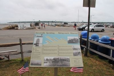
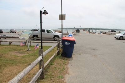
Location. 41° 39.45′ N, 70° 48.784′ W. Marker is in Mattapoisett, Massachusetts, in Plymouth County. Marker can be reached from Water Street south of Cannon Street, on the right when traveling east. This marker is located in the downtown business district, near the waterfront, in the southwest corner of "Ship Yard Park" (which was mislabeled on the Google map), near the wharves public parking area and the driveway that runs from Water Street to the wharves. Touch for map. Marker is in this post office area: Mattapoisett MA 02739, United States of America. Touch for directions.
Other nearby markers. At least 8 other markers are within 6 miles of this marker, measured as the crow flies. Commemorating Mattapoisett's Shipbuilders (within shouting distance of this marker); Ned's Point Light (approx. one mile away); William Bradford (approx. 5 miles away); Fort Phoenix (approx. 5.1 miles away); a different marker also named Fort Phoenix (approx. 5.1 miles away); Major Israel Fearing (approx. 5.1 miles away); Donald R. Bernard (approx. 5.1 miles away); Revolutionary War Cannon (approx. 5.1 miles away). Touch for a list and map of all markers in Mattapoisett.
Credits. This page was last revised on May 28, 2023. It was originally submitted on September 5, 2015, by Dale K. Benington of Toledo, Ohio. This page has been viewed 443 times since then and 20 times this year. Photos: 1, 2, 3, 4, 5, 6. submitted on September 6, 2015, by Dale K. Benington of Toledo, Ohio.
