St. James in St. James Parish, Louisiana — The American South (West South Central)
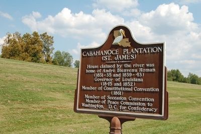
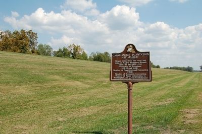
Cabahanoce Plantation
(St. James)
home of André Bienvenu Roman
(1831-35 and 1839-43)
Governor of Louisiana
(1845 and 1852)
Member of Constitutional Convention
(1861)
Member of Secession Convention
Member of Peace Commission to
Washington, D.C. for Confederacy
Erected 1957 by The Louisiana Department of Commerce and Industry.
Topics. This historical marker is listed in these topic lists: Government & Politics • Settlements & Settlers • War, US Civil. A significant historical year for this entry is 1831.
Location. 29° 58.949′ N, 90° 49.833′ W. Marker is in St. James, Louisiana, in St. James Parish. Marker is at the intersection of River Road (State Highway 18) and Post Office Street, on the left when traveling south on River Road. Touch for map. Marker is in this post office area: Saint James LA 70086, United States of America. Touch for directions.
Other nearby markers. At least 8 other markers are within 5 miles of this marker, measured as the crow flies. Manresa House of Retreats (approx. 0.9 miles away); Convent (approx. 1.9 miles away); Judge Poché Plantation House (approx. 2.1 miles away); Site of First Acadian Settlers in Louisiana (approx. 2.4 miles away); St. Jacques de Cabahanoce (approx. 2.4 miles away); Oak Alley Plantation (approx. 3.6 miles away); Uncle Sam Plantation (approx. 3.7 miles away); The Settlement Of Freetown (approx. 4.3 miles away). Touch for a list and map of all markers in St. James.
Credits. This page was last revised on December 11, 2022. It was originally submitted on September 5, 2015. This page has been viewed 1,471 times since then and 139 times this year. Photos: 1, 2. submitted on September 5, 2015. • Bernard Fisher was the editor who published this page.

