Moose in Teton County, Wyoming — The American West (Mountains)
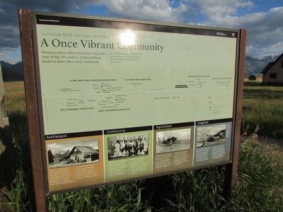
A Once Vibrant Community
Mormon Row Historic District
— Grand Teton National Park —
Homesteaders, who settled here near the turn of the 19-century, clustered their farms to share labor and community.
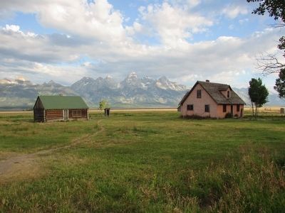
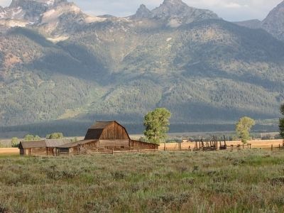
As you walk imagine 33 homesteads surrounding a church and school. Structures from six homesteads remain here.
Settlement
Leaders of the Church of Jesus Christ of Latter-day Saints, or Mormons, sent parties from the Salt lake Valley to find new settlements to support their expanding population. Mormon settlers from Idaho first arrived here in the 1890s. The U.S. Post Office named this community Grovont, now known as “Mormon Row.”
Community
Mormon pioneers formed close-knit communities around their church and school, starkly contrasting with the pattern of isolation typical of many western homesteads.
Families cooperated with each other on large projects, from building barns to digging ditches. Woman worked communally, assisting in neighbors’ births and chores.
Agriculture
Mormon pioneers picked this place for its relatively fertile soil, protection from winds by Blacktail Butte and access to the Gros Ventre River. Despite the harsh conditions of Jackson Hole, Mormon settlers succeeded at growing crops by using irrigation techniques they developed during the 1847 settlement of the Great Basin.
Irrigation
Mormon Row settlers dug ditches by hand or with teams of horses. They built levees and dikes to funnel water from central ditches to their fields. Working together, they built an irrigation network of waterways between 1936 and 1937 to provide crucial water for their crops. Notice the remaining ditches here still flowing with water.
Erected by National Park Service.
Topics. This historical marker is listed in this topic list: Settlements & Settlers.
Location. 43° 39.937′ N, 110° 39.866′ W. Marker is in Moose, Wyoming, in Teton County. Marker is on Antelope Flats Road, on the left when traveling east. Touch for map. Marker is in this post office area: Moose WY 83012, United States of America. Touch for directions.
Other nearby markers. At least 8 other markers are within 3 miles of this marker, measured as the crow flies. Shrinking Teton Glaciers (approx. 1.8 miles away); Making it Last (approx. 2.4 miles away); Staying Cool (approx. 2.4 miles away); Water Filter (approx. 2.4 miles away); Menor’s Ferry (approx. 2.4 miles away); “Mean and Menor” (approx. 2.4 miles away); A National Park Takes Root (approx. 2½ miles away); The Maud Noble Cabin (approx. 2½ miles away). Touch for a list and map of all markers in Moose.
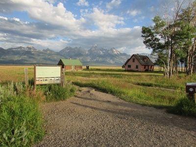
More about this marker. The marker features a map of the Mormon Row Historic District. It identifies the Clark and Veda Moulton Homestead, T. A. Moulton Homestead, Roy Chambers Homestead, Andy Chambers Homestead, John Moulton Homestead, and Reed Moulton Homestead.
Credits. This page was last revised on June 16, 2016. It was originally submitted on September 7, 2015, by Bill Coughlin of Woodland Park, New Jersey. This page has been viewed 325 times since then and 21 times this year. Photos: 1, 2, 3, 4. submitted on September 7, 2015, by Bill Coughlin of Woodland Park, New Jersey.


