Fredericksburg, Virginia — The American South (Mid-Atlantic)
Sunken Road Walking Trail
The Battle of Fredericksburg
— Fredericksburg and Spotsylvania National Military Park —
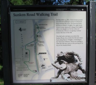
This half-mile trail takes you down the Sunken Road, then climbs the hill and comes back along Marye's Heights, concluding at the National Cemetery. Those not wishing to climb the hill may return to the parking lot by way of the Sunken Road.
Erected by National Park Service, U.S. Department of the Interior.
Topics. This historical marker is listed in this topic list: War, US Civil. A significant historical date for this entry is December 13, 1862.
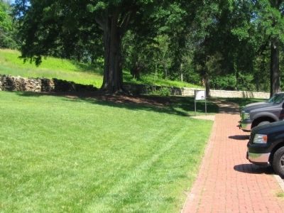
Location. 38° 17.682′ N, 77° 28.077′ W. Marker is in Fredericksburg, Virginia. Marker is at the intersection of Sunken Road and Lafayette Boulevard (Virginia Highway 1), on the right when traveling south on Sunken Road. Located in the parking lot for the Fredericksburg National Battlefield visitor center. The marker is the trail head for the tour. The Sunken Road is closed to vehicle traffic. Touch for map. Marker is in this post office area: Fredericksburg VA 22401, United States of America. Touch for directions.
Other nearby markers. At least 8 other markers are within walking distance of this marker. Field of Battle (within shouting distance of this marker); The Union Attacks Begin (within shouting distance of this marker); Confederate Artillery (within shouting distance of this marker); Fredericksburg Battlefield (within shouting distance of this marker); Fredericksburg and Spotsylvania National Military Park (within shouting distance of this marker); The Confederate Line (within shouting distance of this marker); Battered Buildings on Willis Hill (within shouting distance of this marker); Thomas R. R. Cobb (within shouting distance of this marker). Touch for a list and map of all markers in Fredericksburg.
More about this marker. To the left is a map of the trail indicting monuments and the location of wartime structures. On the lower right is a photo of the Kirkland Monument.
Related markers. Click here for a list of markers that are related to this marker. Sunken Road and Marye's Heights Virtual Tour by Markers
Also see . . . Sunken Road Walking Trail Virtual Tour. National Park Service page. (Submitted on July 5, 2008, by Craig Swain of Leesburg, Virginia.)
Credits. This page was last revised on March 13, 2023. It was originally submitted on July 5, 2008, by Craig Swain of Leesburg, Virginia. This page has been viewed 2,789 times since then and 17 times this year. Last updated on March 12, 2023, by Carl Gordon Moore Jr. of North East, Maryland. Photos: 1, 2, 3. submitted on July 5, 2008, by Craig Swain of Leesburg, Virginia. 4. submitted on July 12, 2008, by Craig Swain of Leesburg, Virginia. • Bernard Fisher was the editor who published this page.


