Near Ballintoy in Causeway Coast and Glens, Northern Ireland, United Kingdom — Northwestern Europe (the British Isles)
Carrick-a-Rede
Causeway Coastal Route
— National Trust —
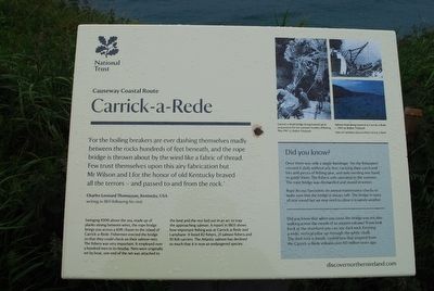
'For the boiling breakers are ever dashing themselves madly between the rocks hundreds of feet beneath, and the rope bridge thrown about by the wind like a fabric of thread. Few trust themselves upon this airy fabrication but Mr Wilson and I for the honor of old Kentucky braved all the terrors - and passed to and from the rock.'
Charles Leonard Thomassan, Kentucky, USA
writing in 1851 following a visit.
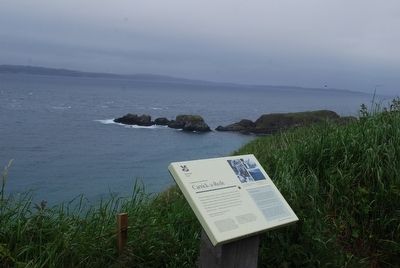
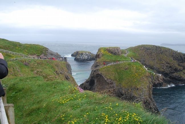
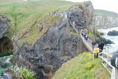
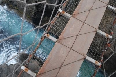
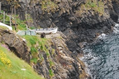
Swinging 100ft above the sea, made up of planks strung between wires, the rope bridge brings you across a 60ft chasm to the island of Carrick-a-Rede. Fisherman erected the bridge so that they could check on their salmon nets. The fishery was very important. It employed over a hundred men in its heyday. Nets were originally set by boat, one end of the net was attached to the land and the rest laid out in an arc to trap the approaching salmon. A report in 1803 shows how important fishing was at Carrick-a-Rede and Larrybane. It listed 82 fishers, 21 salmon fishers and 10 fish carriers. The Atlantic salmon has declined so much that it is now an endangered species.
Did you know?
Once there was only a single handrope. Yet the fishermen crossed it daily without any fear, carrying their catch and bits and pieces of fishing gear, and only needing one hand to guide them. The fishery only operated in the summer. The rope bridge was dismantled and stored in the winter.
Rope Access Specialists do annual maintenance checks to make sure the bridge is always safe. The bridge is open all year round but we may need to close it in windy weather.
Did you know that when you cross the bridge you are also walking across the mouth of an ancient volcano? If you look back at the mainland you can see dark rock forming a wide, vertical pillar up through the white chalk. The dark rock is basalt, cooled lava that erupted from the Carrick-a-Rede volcano over 60 million years ago.
discovernorthernireland.com
(captions)
Carrick-a-Rede bridge being hoisted up in preperation for the summer months of fishing. May 1967
Salmom boat being lowered at Carrick-a-Rede. c.1960
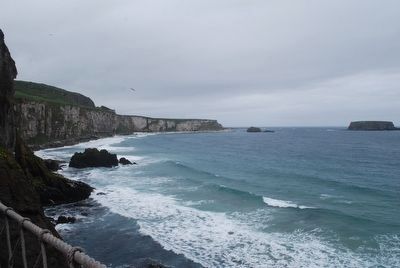
View of Larrybane Quarry from Carrick-a-Rede
Topics. This historical marker is listed in this topic list: Bridges & Viaducts.
Location. 55° 14.364′ N, 6° 19.961′ W. Marker is near Ballintoy, Northern Ireland, in Causeway Coast and Glens. Marker can be reached from Whitepark Road. Touch for map. Marker is at or near this postal address: 119a Whitepark Road, Ballintoy, Northern Ireland BT54 6LS, United Kingdom. Touch for directions.
Other nearby markers. At least 7 other markers are within 13 kilometers of this marker, measured as the crow flies. Dunseverick Castle (approx. 7.4 kilometers away); Alphabet Angel (approx. 12.6 kilometers away); Giant’s Causeway and Bushmills Railway (approx. 12.7 kilometers away); World Wars Memorial (approx. 12.7 kilometers away); Sgt. Robert Quigg (approx. 12.7 kilometers away); Hamill Terrace (approx. 12.7 kilometers away); Bushmills History & Heritage (approx. 12.8 kilometers away).
Credits. This page was last revised on January 27, 2022. It was originally submitted on September 7, 2015, by Brandon Fletcher of Chattanooga, Tennessee. This page has been viewed 357 times since then and 6 times this year. Photos: 1, 2, 3, 4, 5, 6, 7, 8. submitted on September 7, 2015, by Brandon Fletcher of Chattanooga, Tennessee. • Andrew Ruppenstein was the editor who published this page.
