Pleasant Hill in Cass County, Missouri — The American Midwest (Upper Plains)
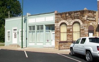
129 Wyoming Street
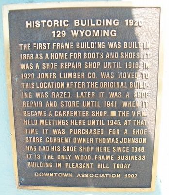
Historic Building 1920
Erected 1992 by Pleasant Hill Downtown Association.
Topics and series. This historical marker is listed in these topic lists: Architecture • Industry & Commerce. In addition, it is included in the Missouri, Pleasant Hill Downtown Association series list. A significant historical year for this entry is 1868.
Location. 38° 47.119′ N, 94° 16.528′ W. Marker is in Pleasant Hill, Missouri, in Cass County. Marker is on Wyoming Street west of 1st Street, on the right when traveling west. Touch for map. Marker is at or near this postal address: 129 Wyoming Street, Pleasant Hill MO 64080, United States of America. Touch for directions.
Other nearby markers. At least 8 other markers are within walking distance of this marker. Historic 115 Wyoming Street (within shouting distance of this marker); 113 Wyoming Street (within shouting distance of this marker); 105 First Street (within shouting distance of this marker); 111 First Street (within shouting distance of this marker); 118 First Street (about 300 feet away, measured in a direct line); 120 First Street (about 300 feet away); 117 First Street (about 300 feet away); 124 First Street (about 300 feet away). Touch for a list and map of all markers in Pleasant Hill.
Also see . . .
1. Pleasant Hill Downtown Historic District, NRHP. (Submitted on September 9, 2015, by William Fischer, Jr. of Scranton, Pennsylvania.)
2. Pleasant Hill Downtown Historic District, NRHP Map. (Submitted on September 9, 2015, by William Fischer, Jr. of Scranton, Pennsylvania.)
3. Historic Pleasant Hill MO. (Submitted on September 9, 2015, by William Fischer, Jr. of Scranton, Pennsylvania.)
Credits. This page was last revised on April 26, 2022. It was originally submitted on September 9, 2015, by William Fischer, Jr. of Scranton, Pennsylvania. This page has been viewed 302 times since then and 11 times this year. Photos: 1, 2. submitted on September 9, 2015, by William Fischer, Jr. of Scranton, Pennsylvania.

