Fredericksburg, Virginia — The American South (Mid-Atlantic)
The Sunken Road
The Battle of Fredericksburg
— Fredericksburg and Spotsylvania National Military Park —
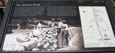
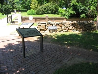
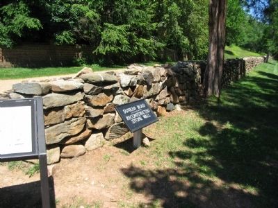
After the Civil War, the road became a typical city street. Much of the original stone wall vanished; houses appeared. But in the 1930s, the National Park Service started reclaiming the road. The Civilian Conservation Corps reconstructed the section of wall in front of you, and the NPS removed postwar houses. In 2004 the road closed to traffic, allowing the NPS to take up its asphalt surface and rebuild the remaining portions of the wall. Today, the road looks much as it did at the time of the battle.
Erected by National Park Service, U.S. Department of the Interior.
Topics and series. This historical marker is listed in these topic lists: Roads & Vehicles • War, US Civil. In addition, it is included in the Civilian Conservation Corps (CCC) series list. A significant historical year for this entry is 1862.
Location. 38° 17.606′ N, 77° 28.051′ W. Marker is in Fredericksburg, Virginia. Marker is at the intersection of Lafayette Boulevard (State Highway 1) and Sunken Road, on the right when traveling west on Lafayette Boulevard. Located at the south entrance to the Fredericksburg National Cemetery. Touch for map. Marker is at or near this postal address: 1012 Lafayette Blvd, Fredericksburg VA 22401, United States of America. Touch for directions.
Other nearby markers. At least 8 other markers are within walking distance of this marker. Fredericksburg National Cemetery (here, next to this marker); The Fifth Corps, Army of the Potomac (within shouting distance of this marker); A Winter Campaign Ends in Union Disaster (within shouting distance of this marker); Fredericksburg and Spotsylvania National Military Park (within shouting distance of this marker); A Segregated Park Service (within shouting distance of this marker); Fredericksburg Battlefield (about 300 feet away, measured in a direct line); 127th Regiment Pennsylvania Volunteer Infantry (about 300 feet away); a different marker also named Fredericksburg National Cemetery (about 300 feet away). Touch for a list and map of all markers in Fredericksburg.
More about this marker. The background of the marker is a photograph of Workers from the Civilian Conservation Corps reconstruct[ing] a missing section of [the] stone wall in 1936. A section of original wall still stands at the northern end of the road.
On the right is a map of the Sunken Road/Marye's Heights walking trail. This half-mile walking tour takes you down the Sunken Road, then climbs the hill, and comes back along Marye's Heights, concluding at the National Cemetery. Those not wishing to climb the hill may return to the parking lot along the Sunken Road.
Also see . . . The Sunken Road. National Park Service (Submitted on July 5, 2008, by Craig Swain of Leesburg, Virginia.)
Credits. This page was last revised on February 9, 2023. It was originally submitted on July 5, 2008, by Craig Swain of Leesburg, Virginia. This page has been viewed 2,040 times since then and 59 times this year. Last updated on February 4, 2023, by Bradley Owen of Morgantown, West Virginia. Photos: 1, 2, 3. submitted on July 5, 2008, by Craig Swain of Leesburg, Virginia. • Bernard Fisher was the editor who published this page.


